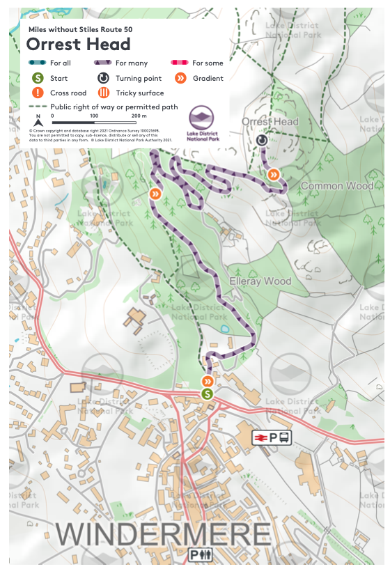
This route (3.5km round trip) summits the fell Orrest Head. The occasionally challenging route with some steep sections winds its way up through Elleray Wood, with 120m of ascent to take you to a high point of 238m where adventurers are rewarded with 360º views over Windermere and the central fells. OS Explorer Map OL7.
Follow the blue signs for the accessible route. There are also red graded footpaths that deviate from the main trail which involve steps.
If you are doing this route on an all-terrain-scooter, we recommend having a full battery, and a scooter able to cope with the steeper sections of the route.
Please note that mobility scooters must be class 2 or 3 on the route.
Please visit the Orrest Head project page for details of the renovation of this route.
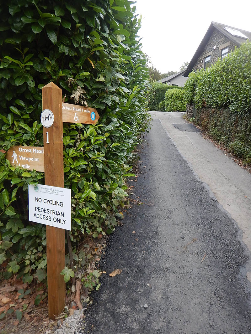
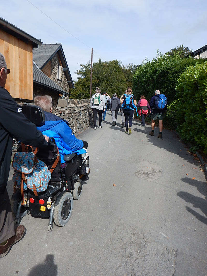
Starting at the narrow lane next to to the lower entrance to the Windermere Hotel [Photo 1], you get a taste of some of the steeper inclines on the first tarmac section [Photo 2]. At a gradient of up to 1:4, this is the steepest section of the route. Passing Elleray cottage and Shireburn [Photo 3], the road bends to the right. Immediately after Orrest Howe, a fine cream coloured house, take the accessible gravel surface on the left at post 2 [Photo 4] before rejoining the tarmac at post 3 [Photo 5] and tackle a longer sweeping left-hand bend [Photo 6].
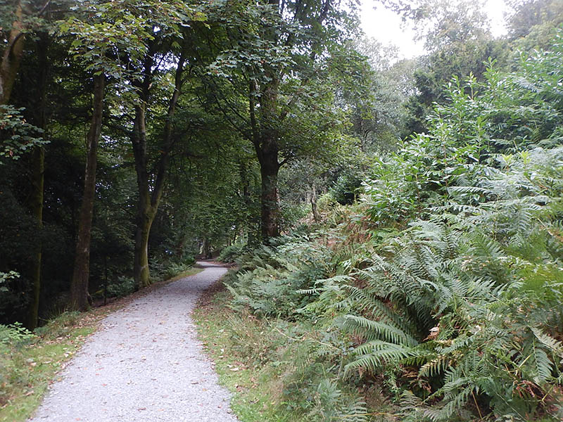
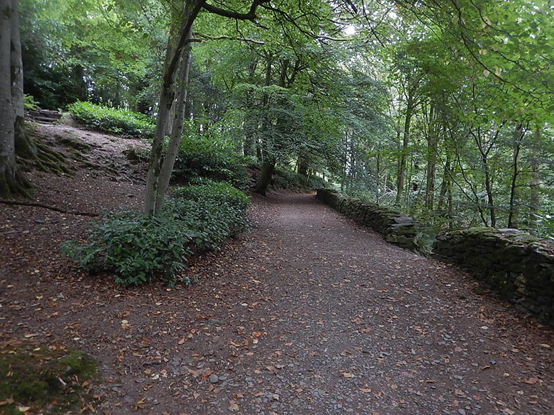
You’ll reach a section where the road pulls sharply to the right, but rather than remain on the road, take the newly restored Victorian Carriageway straight ahead on the corner at post 4, with its accessible gravel surface. As you are enveloped in woodland, the height of the tree trunks is striking as they reach for the light [Photo 7]. You’ll pass, on your left, and perhaps easily missed, a walled garden that would have been used for growing vegetables and fruit in former times.
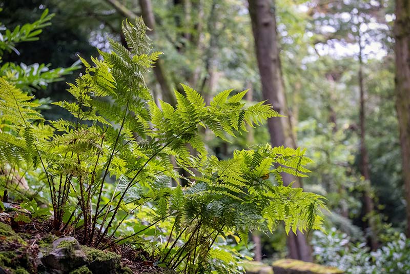
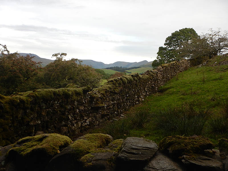
Shortly you’ll become aware of a red path feeding in from the left at post number 6, and the routes combine, bounded by a stone wall for a reasonably demanding climb, passing areas where the rock has been quarried and tree roots now hang on to rocks, and ferns thrive in the cool darkness.
At a base of a huge sycamore tree [Photo 8] the path touches the boundary of the wood at a sharp right-hand corner. Climbing a short distance further [Photo 9], a view of Windermere opens on the right [Photo 10] and eagle-eyed visitors may catch a glimpse of a very special forest dweller. At the wood yard (at post number 8) turn sharp left, and continue upwards through beech trees. Touching the woodland edge for a second time, on a right hand corner, Wansfell, Stoney Cove Pike and Ill Bell can be seen in the distance [Photo 11].
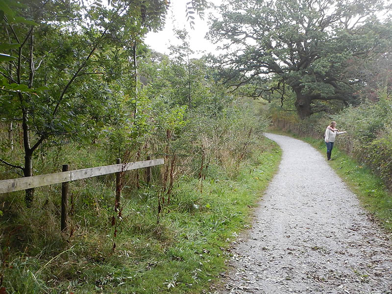
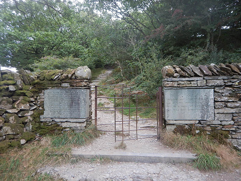
Leaving the Victorian Carriageway and mature woodland, there is a short section of newly planted oaks and native species [Photo 12], before the route sweeps to the right for a third time, with views over the wall to the northern end of Lake Windermere. You’ll find the first of several newly installed benches, specially commissioned for the accessible route. Climbing up the fell, you will pass a Victorian Kissing Gate at post number 11 and associated inscriptions [Photo 13] that acknowledge the generosity of local landowner Arthur Henry Heywood, who so kindly gave the woods and Orrest Head for everyone to enjoy. Also featured is a heart-warming verse, written by clergyman and poet J.Keble.
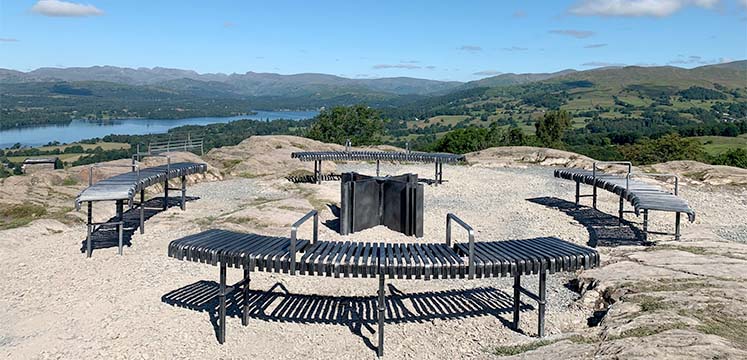
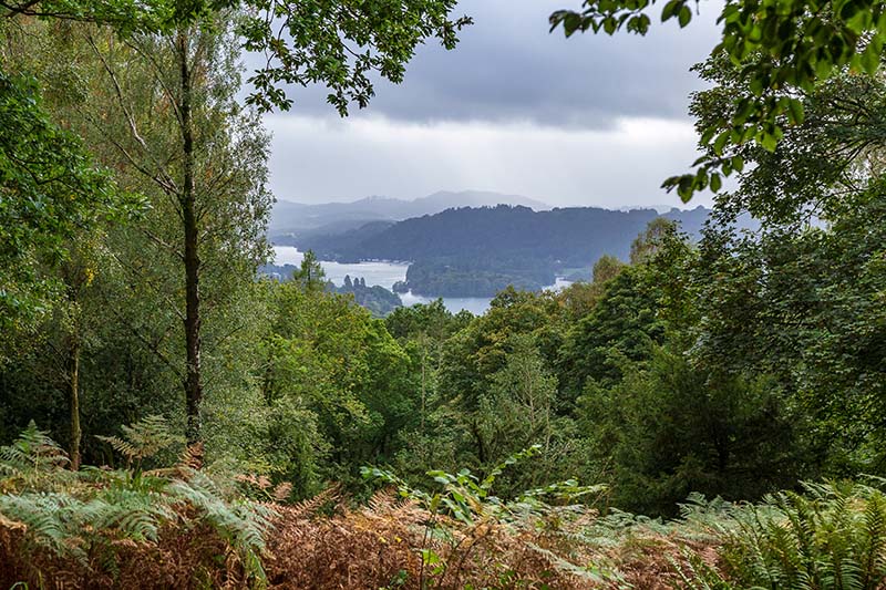
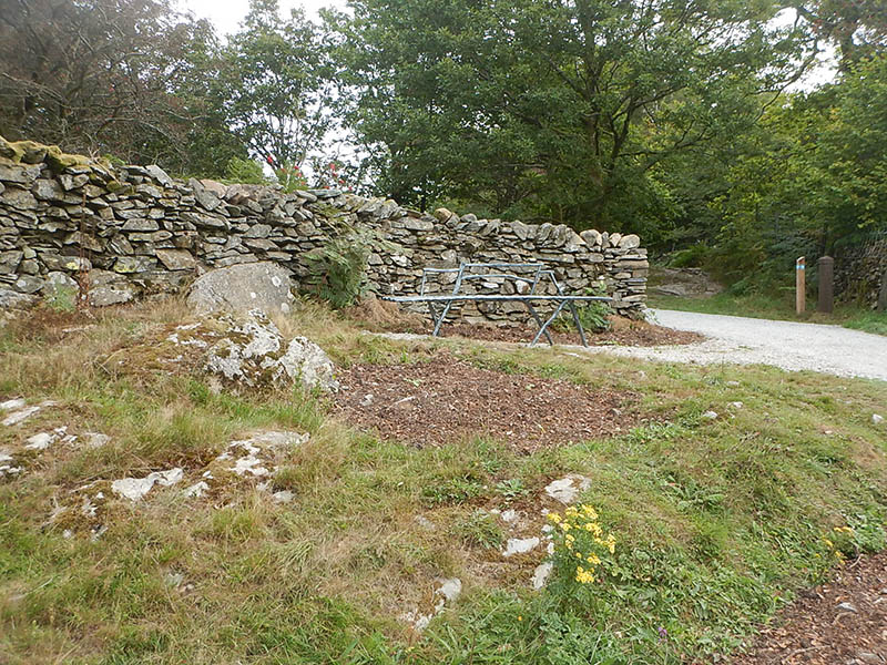
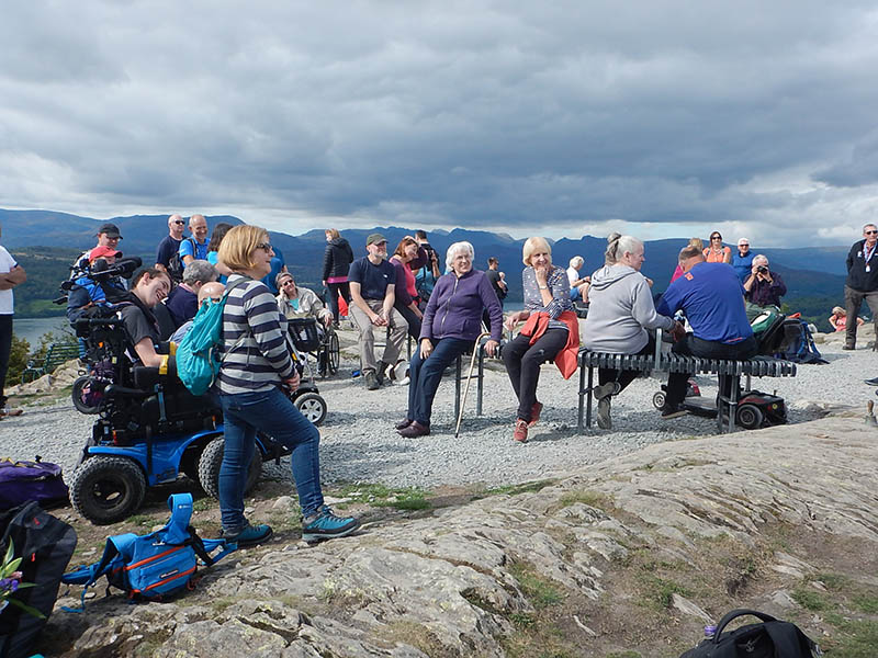
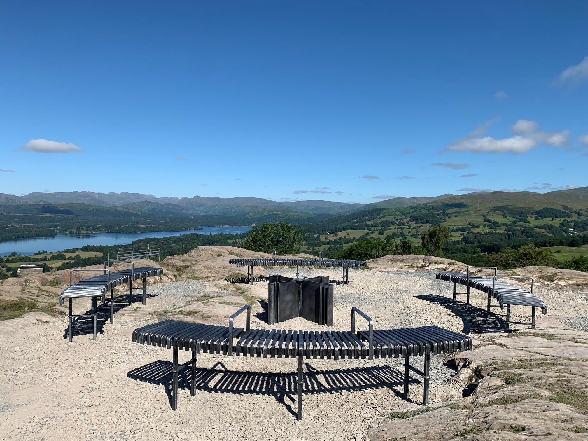
Continuing your ascent, to your right are further tantalising views, before passing through a gap in the wall at post number 12 [Photo 14] and entering a different type of mountain woodland with small oak trees and mountain ash, before the last push to the summit. You break free of woodland and an awe-inspiring 360º panorama is revealed. [Photo 15] Taking in the length of Windermere, the central fells, and parts of the Kentmere horseshoe, you are fully immersed in the wondrous landscape. Pause for a while, utilising the newly installed (and cleverly incorporating a compass) benches by local metalwork artist CB Arts [Photo 16], before turning and retracing your route back down to Windermere.
Please note that the map below has not yet been updated for this 'for some' standard route (mainly due to the steep slope at the start and other slopes of up to 1:7 part way up.
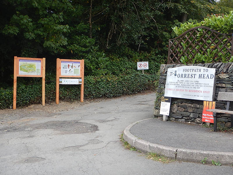
1. The start of the path at the junction with the main road.
2. The first tarmac section with a steep incline.
3. Passing Elleray Cottage and Shireburn.
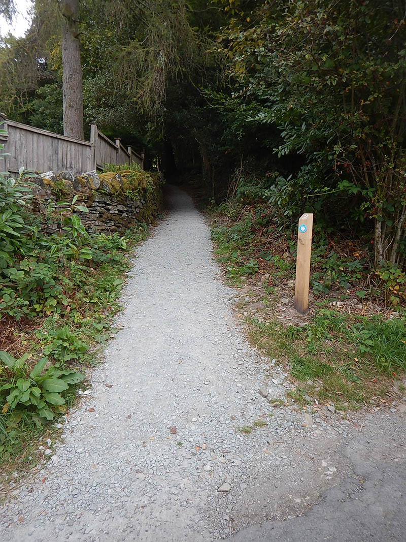
4. The accessible gravel path to the left.
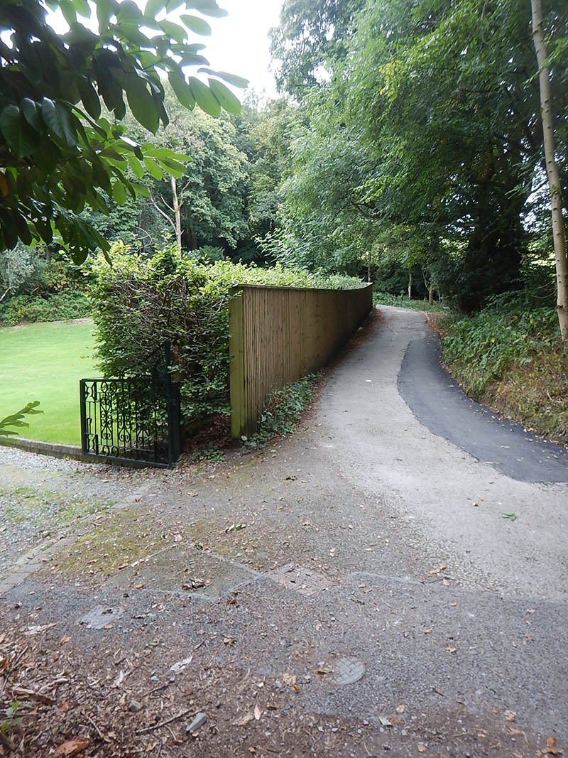
5. Rejoining the tarmac road.
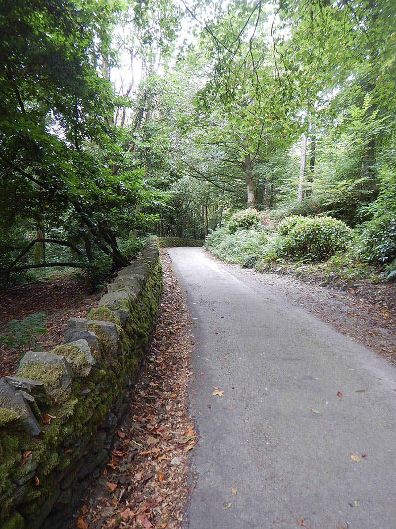
6. A long sweeping left hand bend on the tarmac road.
7. Tall trees on either side of the path.
8. Elleray Woods are rich with flora and fauna.
9. The path climbs further through the woods.
10. Views in the direction of Belle Isle and Far Sawrey.
11. Views over the fells in the distance.
12. Newly planted oaks and native species.
13. The path passes a Victorian kissing gate, but does not go through it.
14. The path passes through a gap in the wall at post 12.
15. The summit of Orrest Head fell.
16. The new seating which incorporates a compass into the design.
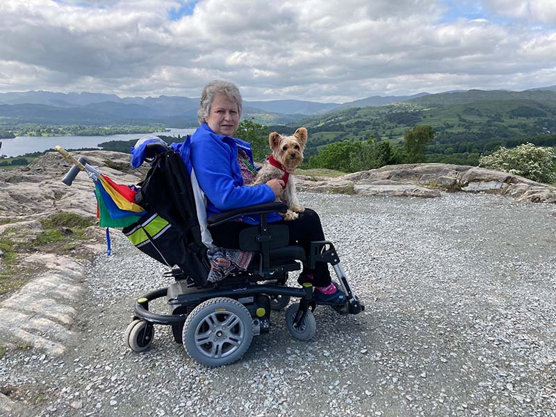
17. The view from Orrest Head summit in an all-terrain wheelchair.
Part funded by the European Agricultural Fund for Rural Development (Rural Development Programme for England).

Where the narrow lane next to the lower entrance of the Windermere Hotel leaves the main road.
Postcode: LA23 1AW
Grid reference: SD 41284 98743
W3W: ///opposing.unfocused.bike
Grid reference: SD 41415 99350
W3W: ///leap.newly.dictation
There are public toilets at Broad Street in Windermere village, along with lots of cafes and shops.
The start point is just 3 minutes from Windermere Station, which has regular train services from Kendal, Oxenholme and beyond on the Lakes Line. Frequent bus services also call at Windermere Station linking many local destinations including Ambleside, Bowness and Kendal. There is parking in Windermere village and a car park at Broad Street.