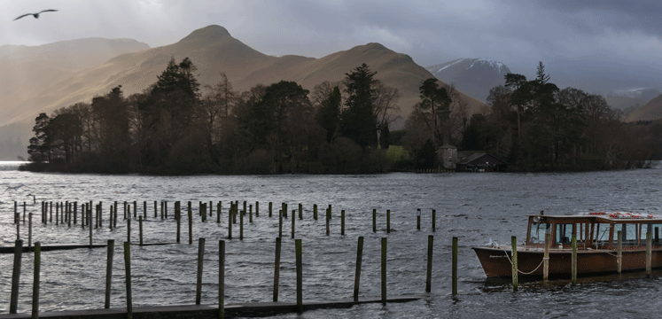
The Northern Lake District Distinctive Area is a mixture of upland limestone, high fell fringe, rugged high fell and upland valleys – from gently rolling improved farmland to the rounded mountain massifs of Skiddaw and Blencathra. Oak woodland is a distinctive landscape feature of the area.
There are significant tracts of common land including the Buttermere, Brackenthwaite, Caldbeck and Uldale Commons. Keswick and smaller settlements lie in valleys containing several lakes: Derwentwater, Bassenthwaite, Thirlmere, Buttermere, Loweswater and Crummock Water.
Thirlmere is significant as it is also a reservoir. The reservoir and surrounding valley is owned by United Utilities, a private water company, and still supplies over 220 million litres of water a day to Manchester and parts of Cumbria and Lancashire.
Bassenthwaite Lake is one of the largest water bodies in the Lake District. It is the only body of water in the Lake District to use the word "lake" in its name, all the others being "waters".
Take a look at what's going in and around the North Lake District
Each year £10,000 was given to projects across the National Park that contributed towards the sustainability or wellbeing of resident communities. The scheme ended in 2020.
Find out more about the Grants awarded.
Find out how we manage maintenance issues on Rights of Way and how to report a problem.
Report a problem on Right of WayZoom in and click anywhere on the map below to find the Area Ranger responsible for that area:
Area Rangers are your key community contact. They lead cross-service working and coordinate work programmes.
Our rangers organise and deliver practical environmental, access and recreation work. They are your first point of contact for issues with Rights of Way.
Take a look at what's going in and around the East of the Lake District:
[ ** RECURSION WARNING ** ]The rugged and craggy high fells of Helvellyn, Fairfield and High Street are split by the two upland valleys of Ullswater and Haweswater / Lowther. Farmland fringes the north-eastern margin of the East area, which contrasts with the high fells.
The East distinctive area is predominantly rural and tranquil and has the lowest population of any of the distinctive areas. Glenridding / Patterdale is the largest settlement, with other smaller villages including Askham, Pooley Bridge and Penruddock.
Ullswater is one of the four navigable lakes in the National Park, whilst Haweswater is a reservoir providing water supplies for the North West of England.
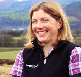
Suzy is the Area Ranger for the East Area of the Lake District. Please get in touch with Suzy if you have any queries or enquiries about our work in the East, potential projects or community fund applications.
Tel: 01768 871409
Mobile: 07799 075114
£50,701 has been awarded in this area to date.
Take a look at what's going in and around the South Lake District
Each year £10,000 was given to projects across the National Park that contributed towards the sustainability or wellbeing of resident communities. The scheme ended in 2020.
Find out more about the Grants awarded.
Find out how we manage maintenance issues on Rights of Way and how to report a problem.
Report a problem on Right of WayZoom in and click anywhere on the map below to find the Area Ranger responsible for that area:
Area Rangers are your key community contact. They lead cross-service working and coordinate work programmes.
Our rangers organise and deliver practical environmental, access and recreation work. They are your first point of contact for issues with Rights of Way.
Take a look at what's going in and around the East of the Lake District:
[ ** RECURSION WARNING ** ]The rugged and craggy high fells of Helvellyn, Fairfield and High Street are split by the two upland valleys of Ullswater and Haweswater / Lowther. Farmland fringes the north-eastern margin of the East area, which contrasts with the high fells.
The East distinctive area is predominantly rural and tranquil and has the lowest population of any of the distinctive areas. Glenridding / Patterdale is the largest settlement, with other smaller villages including Askham, Pooley Bridge and Penruddock.
Ullswater is one of the four navigable lakes in the National Park, whilst Haweswater is a reservoir providing water supplies for the North West of England.
Suzy is the Area Ranger for the East Area of the Lake District. Please get in touch with Suzy if you have any queries or enquiries about our work in the East, potential projects or community fund applications.
Tel: 01768 871409
Mobile: 07799 075114
£50,701 has been awarded in this area to date.
Take a look at what's going in and around the South Lake District
[ ** RECURSION WARNING ** ]The South Distinctive Area stretches from the West of Windermere over towards Coniston Water, the Old Man of Coniston and its range of fells. The eastern part of the area consists of heavily wooded low fells and valleys, which to the south move into low fell fringe, coastal margins, estuary and marsh around the Leven and Duddon estuaries.
The Lake District National Park Authority owns small areas of land in the Southern area. These are Rusland Moss National Nature Reserve, Rusland Woods which include the areas of Border Moss, Yewbarrow, Hall Brow, Stoney Hazel and Thwaite Head, Rusland Tannery and High Dam
The other large landowners in the area are the Forestry Commission which own Grizedale Forest. The National Trust also own large areas of land and attractions in the Southern including Wray Castle, Hill Top (home of Beatrix Potter) and Claife Heights. The Southern area also includes Consiton Water and the historic house of Brantwood.
The following attractions can be visited in the area:
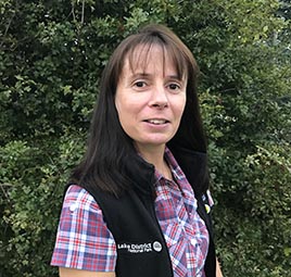
Sara is the Area Ranger for the Southern Lake District. Please get in touch with Sara if you have any queries or enquiries about our work in the South or community fund applications.
Tel: 01539 792719
Mobile: 07788 658566
We are working closely with three community projects in the Southern area that have been given Heritage Lottery Fund grants. These include:
£48,972 has been awarded in grants to this area from the Lake District Communities Fund.
The South Distinctive Area stretches from the West of Windermere over towards Coniston Water, the Old Man of Coniston and its range of fells. The eastern part of the area consists of heavily wooded low fells and valleys, which to the south move into low fell fringe, coastal margins, estuary and marsh around the Leven and Duddon estuaries.
The Lake District National Park Authority owns small areas of land in the Southern area. These are Rusland Moss National Nature Reserve, Rusland Woods which include the areas of Border Moss, Yewbarrow, Hall Brow, Stoney Hazel and Thwaite Head, Rusland Tannery and High Dam
The other large landowners in the area are the Forestry Commission which own Grizedale Forest. The National Trust also own large areas of land and attractions in the Southern including Wray Castle, Hill Top (home of Beatrix Potter) and Claife Heights. The Southern area also includes Consiton Water and the historic house of Brantwood.
The following attractions can be visited in the area:
Sara is the Area Ranger for the Southern Lake District. Please get in touch with Sara if you have any queries or enquiries about our work in the South or community fund applications.
Tel: 01539 792719
Mobile: 07788 658566
We are working closely with three community projects in the Southern area that have been given Heritage Lottery Fund grants. These include:
£48,972 has been awarded in grants to this area from the Lake District Communities Fund.
The rugged and craggy high fells of Helvellyn, Fairfield and High Street are split by the two upland valleys of Ullswater and Haweswater / Lowther. Farmland fringes the north-eastern margin of the East area, which contrasts with the high fells.
The East distinctive area is predominantly rural and tranquil and has the lowest population of any of the distinctive areas. Glenridding / Patterdale is the largest settlement, with other smaller villages including Askham, Pooley Bridge and Penruddock.
Ullswater is one of the four navigable lakes in the National Park, whilst Haweswater is a reservoir providing water supplies for the North West of England.
Suzy is the Area Ranger for the East Area of the Lake District. Please get in touch with Suzy if you have any queries or enquiries about our work in the East, potential projects or community fund applications.
Tel: 01768 871409
Mobile: 07799 075114
£50,701 has been awarded in this area to date.
Take a look at what's going in and around the South Lake District
Each year £10,000 was given to projects across the National Park that contributed towards the sustainability or wellbeing of resident communities. The scheme ended in 2020.
Find out more about the Grants awarded.
Find out how we manage maintenance issues on Rights of Way and how to report a problem.
Report a problem on Right of WayZoom in and click anywhere on the map below to find the Area Ranger responsible for that area:
Area Rangers are your key community contact. They lead cross-service working and coordinate work programmes.
Our rangers organise and deliver practical environmental, access and recreation work. They are your first point of contact for issues with Rights of Way.
Take a look at what's going in and around the East of the Lake District:
[ ** RECURSION WARNING ** ]The rugged and craggy high fells of Helvellyn, Fairfield and High Street are split by the two upland valleys of Ullswater and Haweswater / Lowther. Farmland fringes the north-eastern margin of the East area, which contrasts with the high fells.
The East distinctive area is predominantly rural and tranquil and has the lowest population of any of the distinctive areas. Glenridding / Patterdale is the largest settlement, with other smaller villages including Askham, Pooley Bridge and Penruddock.
Ullswater is one of the four navigable lakes in the National Park, whilst Haweswater is a reservoir providing water supplies for the North West of England.
Suzy is the Area Ranger for the East Area of the Lake District. Please get in touch with Suzy if you have any queries or enquiries about our work in the East, potential projects or community fund applications.
Tel: 01768 871409
Mobile: 07799 075114
£50,701 has been awarded in this area to date.
Take a look at what's going in and around the South Lake District
[ ** RECURSION WARNING ** ]The South Distinctive Area stretches from the West of Windermere over towards Coniston Water, the Old Man of Coniston and its range of fells. The eastern part of the area consists of heavily wooded low fells and valleys, which to the south move into low fell fringe, coastal margins, estuary and marsh around the Leven and Duddon estuaries.
The Lake District National Park Authority owns small areas of land in the Southern area. These are Rusland Moss National Nature Reserve, Rusland Woods which include the areas of Border Moss, Yewbarrow, Hall Brow, Stoney Hazel and Thwaite Head, Rusland Tannery and High Dam
The other large landowners in the area are the Forestry Commission which own Grizedale Forest. The National Trust also own large areas of land and attractions in the Southern including Wray Castle, Hill Top (home of Beatrix Potter) and Claife Heights. The Southern area also includes Consiton Water and the historic house of Brantwood.
The following attractions can be visited in the area:
Sara is the Area Ranger for the Southern Lake District. Please get in touch with Sara if you have any queries or enquiries about our work in the South or community fund applications.
Tel: 01539 792719
Mobile: 07788 658566
We are working closely with three community projects in the Southern area that have been given Heritage Lottery Fund grants. These include:
£48,972 has been awarded in grants to this area from the Lake District Communities Fund.
The South Distinctive Area stretches from the West of Windermere over towards Coniston Water, the Old Man of Coniston and its range of fells. The eastern part of the area consists of heavily wooded low fells and valleys, which to the south move into low fell fringe, coastal margins, estuary and marsh around the Leven and Duddon estuaries.
The Lake District National Park Authority owns small areas of land in the Southern area. These are Rusland Moss National Nature Reserve, Rusland Woods which include the areas of Border Moss, Yewbarrow, Hall Brow, Stoney Hazel and Thwaite Head, Rusland Tannery and High Dam
The other large landowners in the area are the Forestry Commission which own Grizedale Forest. The National Trust also own large areas of land and attractions in the Southern including Wray Castle, Hill Top (home of Beatrix Potter) and Claife Heights. The Southern area also includes Consiton Water and the historic house of Brantwood.
The following attractions can be visited in the area:
Sara is the Area Ranger for the Southern Lake District. Please get in touch with Sara if you have any queries or enquiries about our work in the South or community fund applications.
Tel: 01539 792719
Mobile: 07788 658566
We are working closely with three community projects in the Southern area that have been given Heritage Lottery Fund grants. These include:
£48,972 has been awarded in grants to this area from the Lake District Communities Fund.
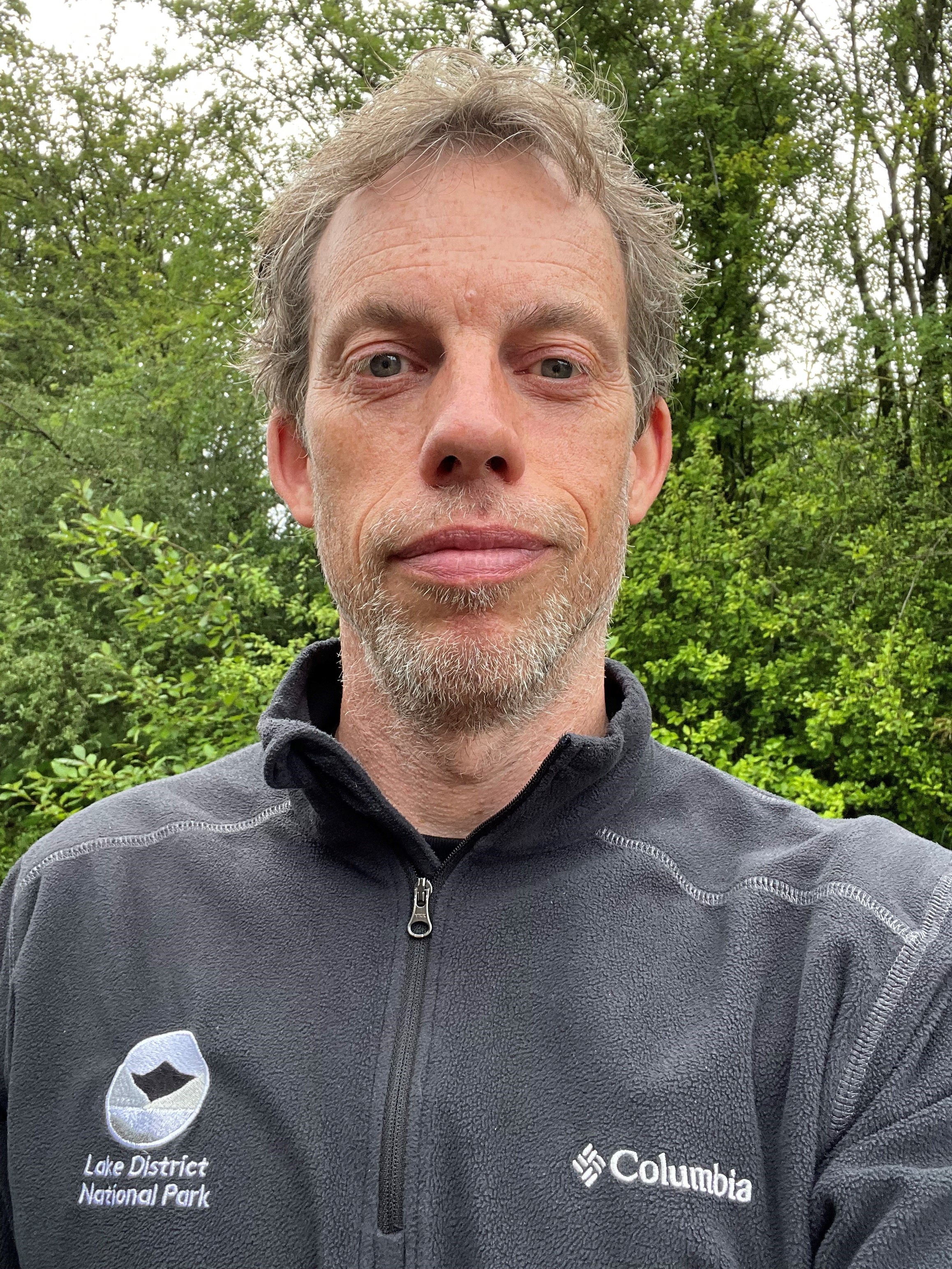
Carl is the Area Ranger for the North area of the Lake District. Please get in touch with Carl if you have any queries or enquiries about our work in this region, potential projects or community fund applications.
Tel:
£56,614 has been awarded to this area to date.