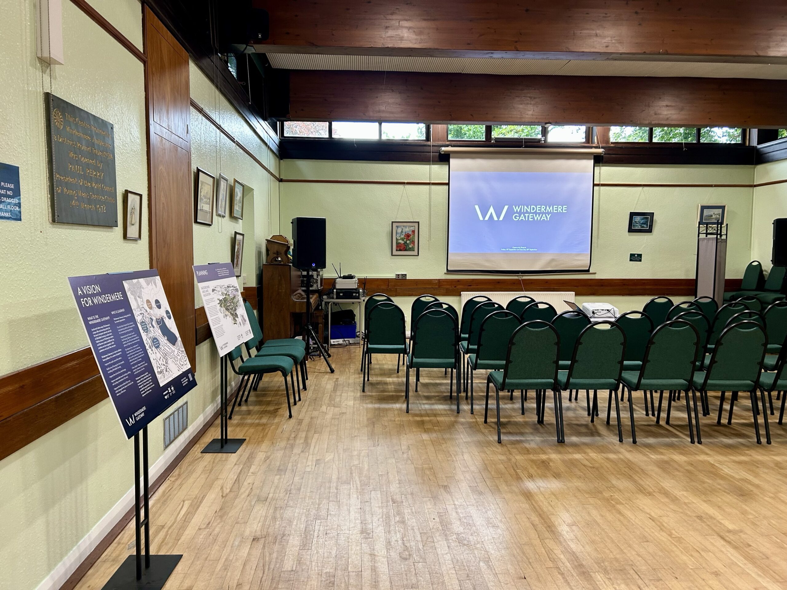
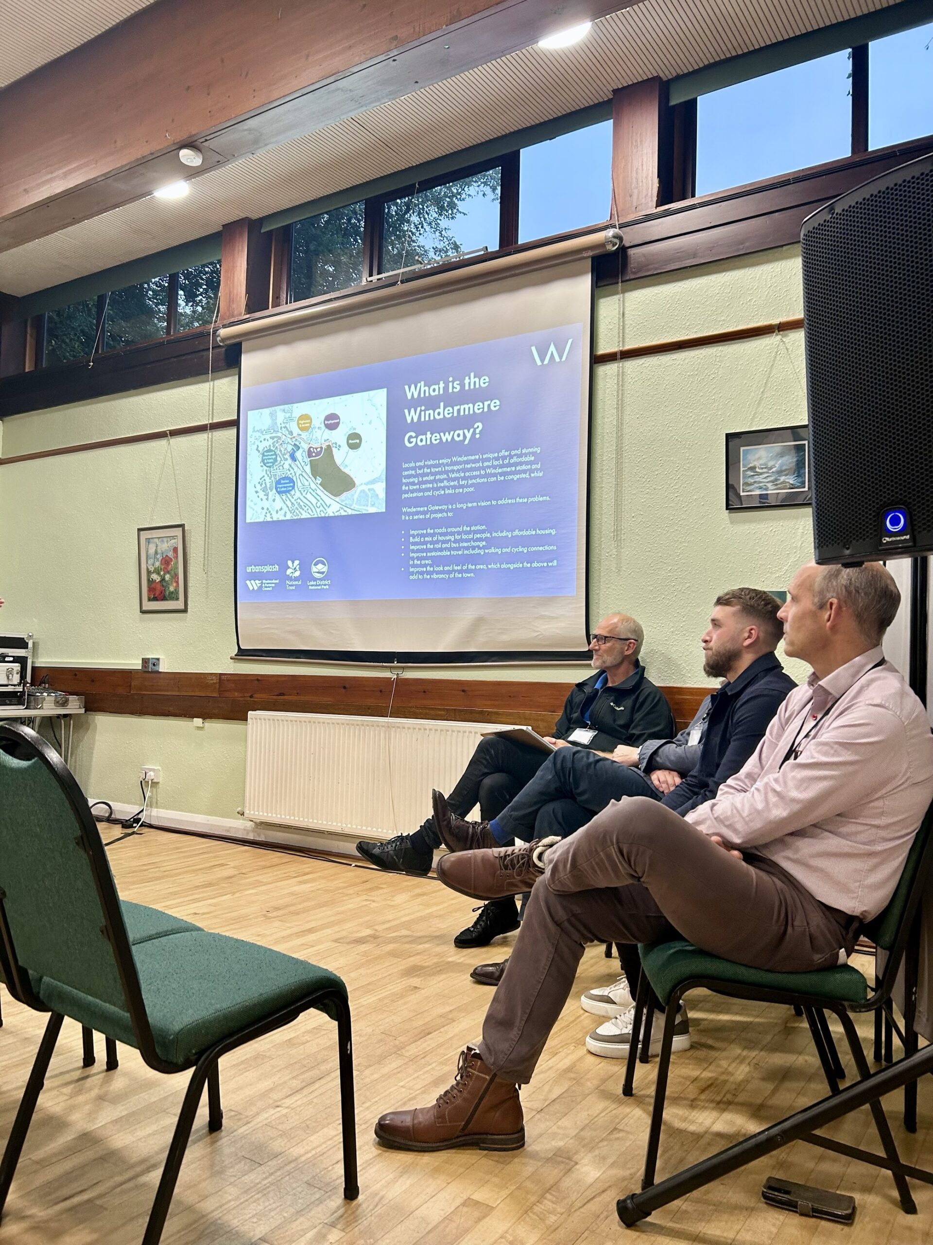
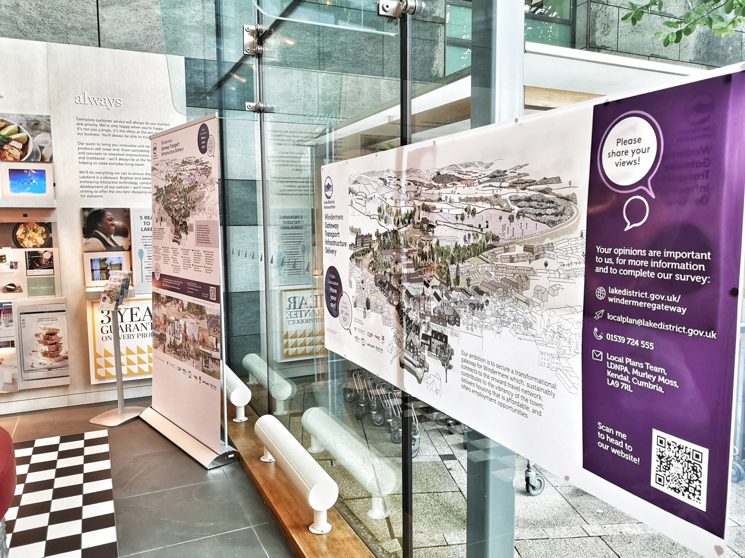
What is the Windermere Gateway?
Windermere Gateway is a vision to address these problems.
It is a series of projects to:
- Improve the roads around the station.
- Build a mix of housing for local people, including affordable housing.
- Improve the rail and bus interchange.
- Improve sustainable travel including walking and cycling connections in the area.
- Improve the look and feel of the area, which will add to the vibrancy of the town.
Who is leading?
Windermere Gateway is being jointly led by several organisations:
- Lake District National Park Authority – local planning authority with responsibility for overseeing planning decisions.
- Westmorland and Furness Council – local housing, highways and transport authority, who will also be responsible for delivery of highways improvement works.
- National Trust – landowner of Orrest Head farm site. It is releasing some of this land so the homes can be built, as well as planning to build a new office for the charity to relocate from its current location in Grasmere.
- Urban Splash – Regeneration and property company who plan to design and build homes on the site.
Windermere Gateway regularly engages with key stakeholders, local businesses and adjacent landowners through the ‘Vision Group’, which provides the opportunity to share progress, offer feedback and ensure alignment with the vision.
What's happening now?
Work starts on refining Windermere Gateway vision for arrival to the Lake District
Westmorland and Furness Council has appointed consultants Mott MacDonald to draw up a concept masterplan for the Windermere station area, to create a transformational welcome to the Lake District by improving the station, its surroundings and facilities.
This work will build on the Windermere Gateway Transport Infrastructure SPD (Supplementary Planning Document) adopted by the Lake District National Park Authority in 2021 and be used as a key focus for securing investment for the proposed upgrades.
Read the full press release on the Westmorland and Furness Council website.
The Windermere Gateway programme remains a strategic priority for partners, with continued commitment to delivering affordable and local needs housing, station and transport improvements, and place‑making ambitions. Following Westmorland & Furness Council’s decision not to proceed with the Homes England Grant Funding Agreement, the highways programme cannot progress in its current form and associated timelines for the housing and employment planning application are now under review.
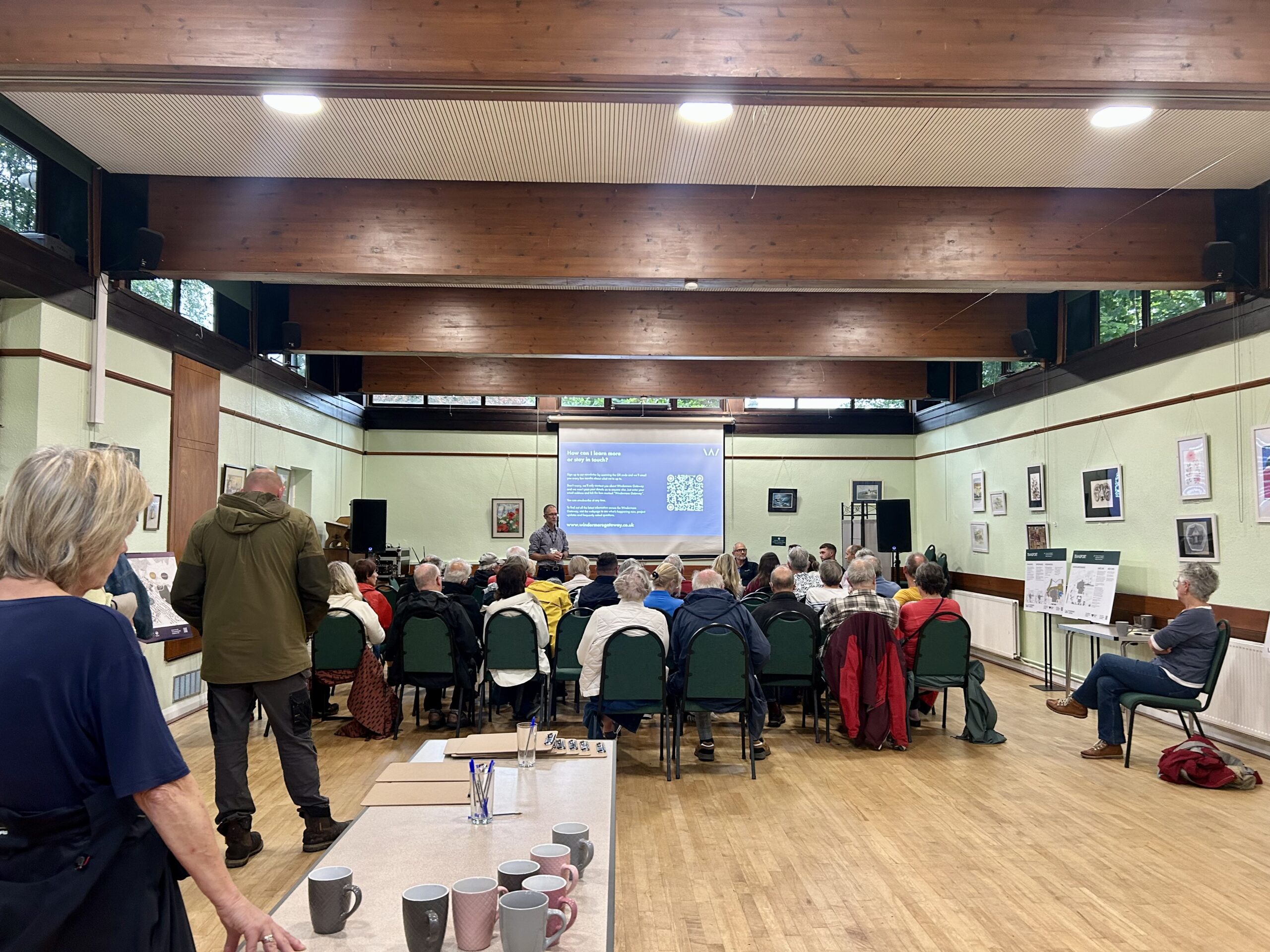
How can I learn more or stay in touch?
Sign up to our newsletter by following the link below, and we’ll email you every few months about what we’re up to and if we’re holding events to attend.
Sign up the Windermere Gateway Newsletter.
Don’t worry, we’ll only contact you about Windermere Gateway and we won’t pass your details on to anyone else. Just enter your email address and tick the box marked ‘Windermere Gateway’. You can unsubscribe at any time.
Progress so far and what's to come
Take a look below to see all we’ve achieved so far – and the plans still to come. It’s early days, but we’re making great progress and working hard to secure funding to bring it all to life.
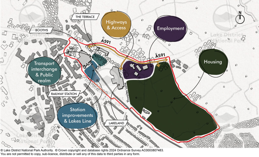
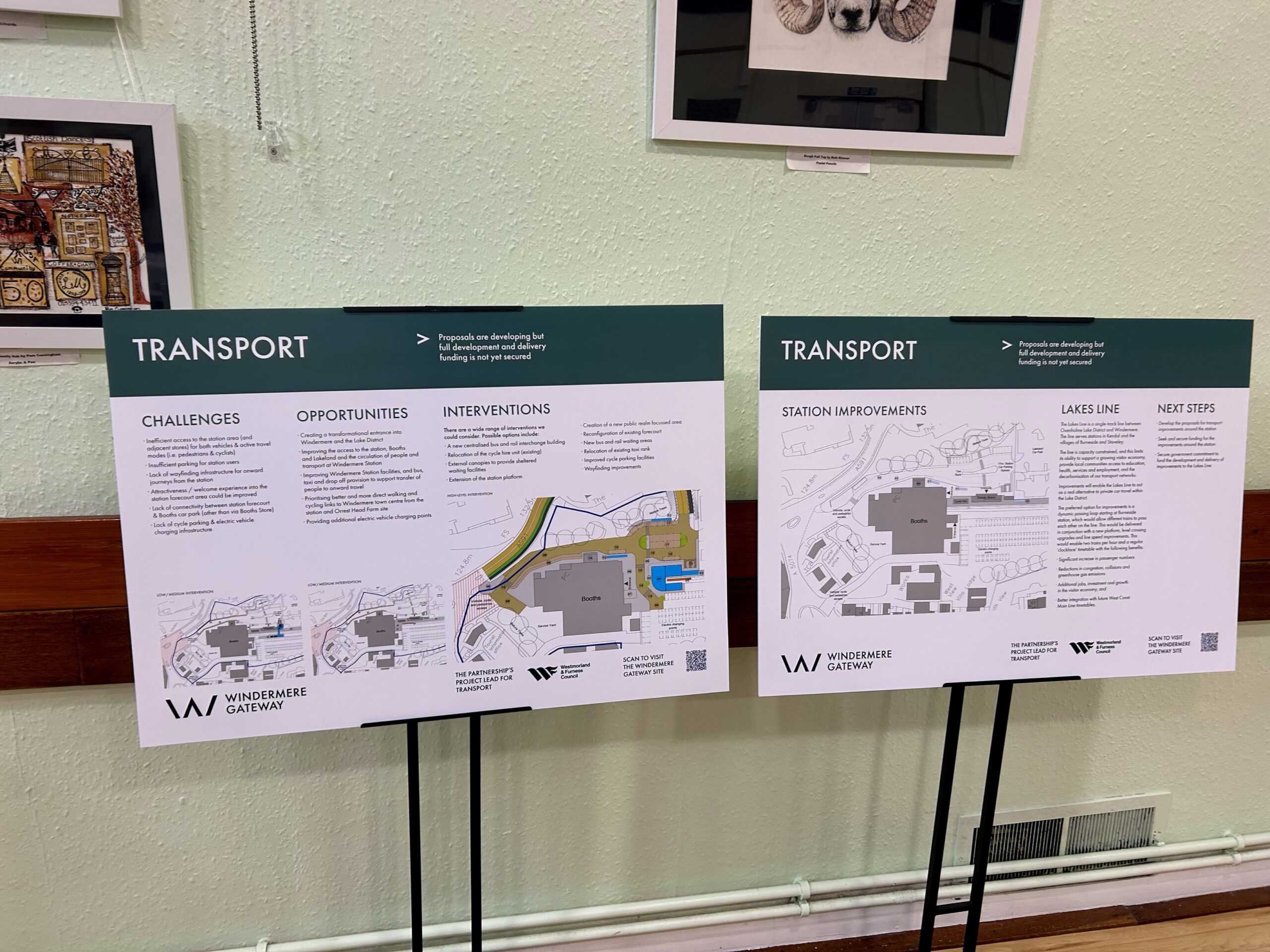
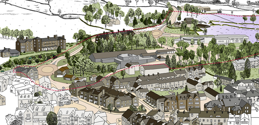
Transport improvements and public realm
Improvements to the existing railway station at Windermere will create an enhanced sense of arrival and better facilities for rail and bus passengers to the town, offering visitors a greater, world-class welcome to the Lake District.
Aspirations for Windermere’s new transport interchange seek to create a hub of activity for a range of passengers in addition to significant upgrades to the immediate area through forecourt enhancements, public realm interventions and improved wayfinding.
So far we have:
- Conducted a feasibility study to look at what options might be possible and how much they cost. It’s early days but we’re looking at options and funding to:
- Improve the ‘sense of arrival’ when you arrive by train or bus and improve facilities at the station.
- Improve the forecourt for taxis, buses and drop-offs
- Improve connections for walking and cycling on into town.
- Submitted plans to government to seek funds for a new passing loop and platform at Burneside. This would allow two trains per hour, meaning a significant increase in passenger numbers, reduction in road congestion, collisions and greenhouse gases.
In future we hope to:
- Seek and secure funding for the significant changes around the station. These would be developed into specific proposals that we can consult and seek public feedback on.
- Secure government commitment to fund the passing loop improvement.
Highways
In bringing forward much-needed homes for Windermere, it’s important that necessary infrastructure improvements are first made in order to facilitate any future development.
Plans, which were approved in November 2024, pave the way for highways improvements including the creation of a new pedestrian route, enhanced cycle connections, and upgrades to the A591 and Thwaites Lane.
VIew the planning application and committee report.
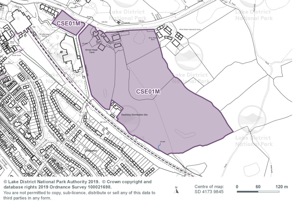
This would be the first stage to unlocking land at Orrest Head Farm – allocated for housing and employment – which remains subject to planning approval.
In future we hope to:
- Secure funding to deliver the highways improvement works.
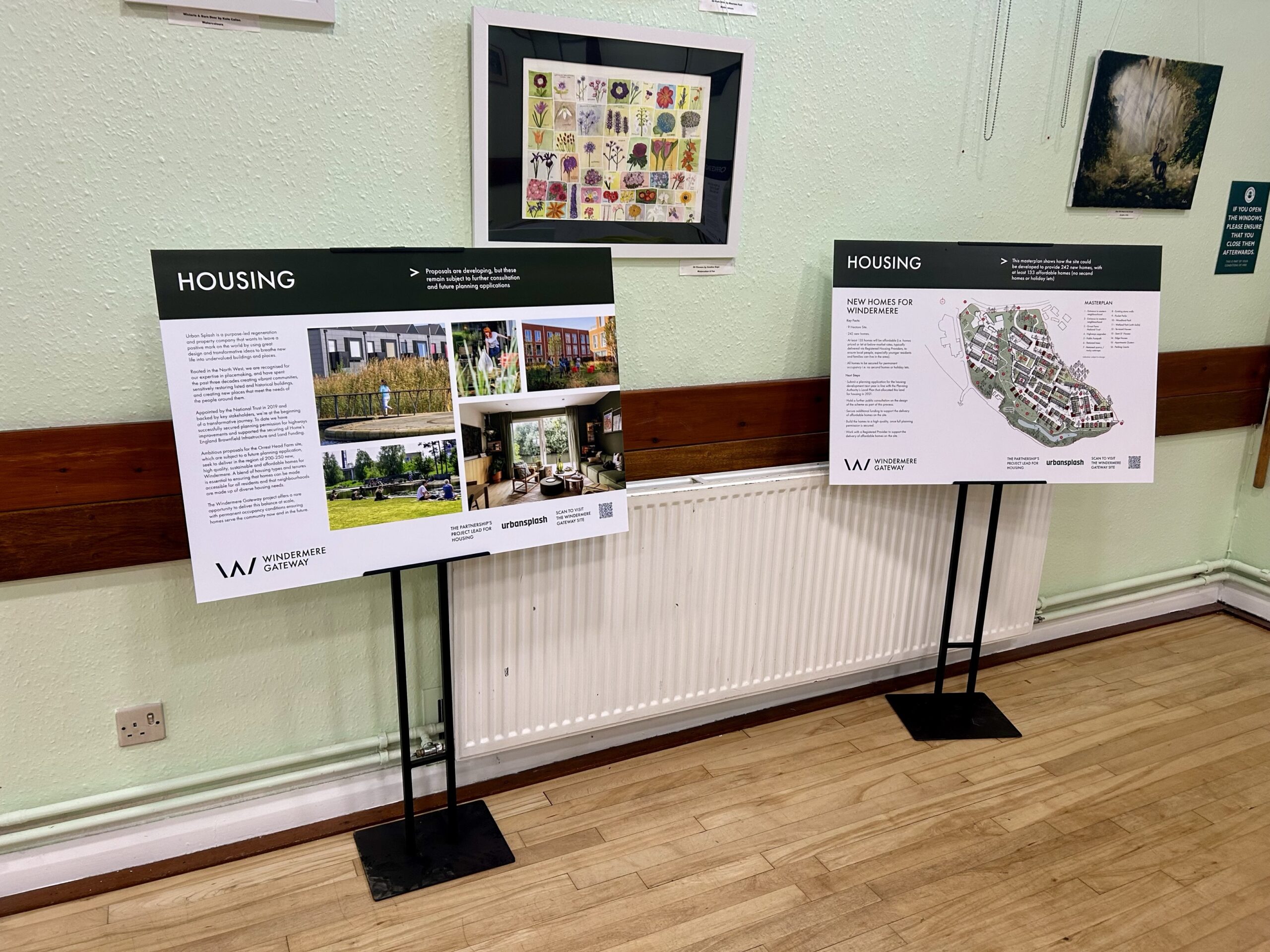
Housing
In 2019, Urban Splash were appointed by landowner, National Trust, as developer partner to take forward the vision for housing on the allocated land at Orrest Head Farm.
Ambitious proposals, which are subject to a future planning application, seek to deliver in the region of 200-250 new, high quality and sustainable homes for Windermere.
In line with policy, all homes will be secured for permanent occupancy, i.e. not second homes or holiday lets. Urban Splash will be working with a registered provider to bring forward affordable homes on the site.
So far we have:
- Begun developing initial proposals for new homes for the Orrest Head Farm site, on the north-west edge of Windermere.
In future we hope to:
- Submit an outline planning application for the housing development in line with the Planning Authority’s Local Plan that allocated this land for housing in 2021.
- Secure additional funding to support the delivery of affordable homes on the site.
- Build the homes to a high quality, once full planning permission is secured.
- Work with a Registered Provider to support the delivery of affordable homes on the site.
National Trust Office
As part of the Windermere Gateway, the National Trust plan to move from its current Grasmere office to a new, purpose-built office at the Orrest Head Farm site. This new office seeks to create a sustainable working space that is fit for the future and meets the changing needs of the charity’s staff and partners.
The opportunity for a new office will provide a central point for National Trust staff to deliver their work, creating collaborative working space next to transport links for sustainable travel and supporting accessible working for their teams.
So far we have:
- Begun developing a proposal for a new, purpose-built office at the Orrest Head Farm site. This new office seeks to create a sustainable working space that is fit for the future and meets the changing needs of the charity’s staff, volunteers and partners. This will enable the Trust to move from its current Grasmere office to the Windermere site.
In future we hope to:
- Submit an outline planning application for the office proposals in line with the Planning Authority’s Local Plan that allocated this land for employment in 2021.
- Build the office to high quality once full planning permission is secured.
Frequently asked questions
Yes. Delivering much needed homes to meet affordable and local needs on the allocated site at Orrest Head Farm remains a significant strategic priority. Urban Splash remains committed to continue working with the lead partners (National Trust, W&FC, LDNPA) to explore possible options.
We have previously told stakeholders that, in order to meet the timetable requirements of the Homes England funding, the outline planning application for housing would need to be submitted and determined before any highways work start on site. As the highways work is not going ahead in its current form, the planning application timetable for the housing is now also under review.
The development at Orrest Head Farm includes plans for a new office for the Trust’s staff, volunteers and partners working in the Lake District. However, the timeline for the office is being reviewed as part of the overall proposal for the site.
Opportunities for improvements to the Station and wider transport ambitions continue to be an important part of the vision for Windermere Gateway.
Westmorland and Furness Council has appointed consultants Mott MacDonald to draw up a concept masterplan for the Windermere station area, to create a transformational welcome to the Lake District by improving the station, its surroundings and facilities.
This work will build on the Windermere Gateway Transport Infrastructure SPD (Supplementary Planning Document) adopted by the Lake District National Park Authority in 2021 and be used as a key focus for securing investment for the proposed upgrades.
Yes. Seeking government commitment and significant funding to progress the plans for Lakes Line improvements and unlock wider benefits for passengers in the region remains a priority and continues to be actively pursued by partners.
Occupying a property in breach of a local occupancy clause is unlawful. If a condition is breached the Authority can served an enforcement notice or breach of condition notice. Failure to comply with those notices is a criminal offence and risks prosecution, and unlimited fine upon indictment. Breaches of planning obligations (i.e. Section 106s) are enforced by injunction, with potential for damages to be owed. Failure to comply with an injunction risks imprisonment.
The Authority is one of the most active for enforcement action. In the last five years, we served 17 enforcement notices/breach of condition notices/ planning contravention notices in relation to breaches of occupancy condition (out of 186 notices in total). Those notices secured compliance and prosecution has not been required in those cases.