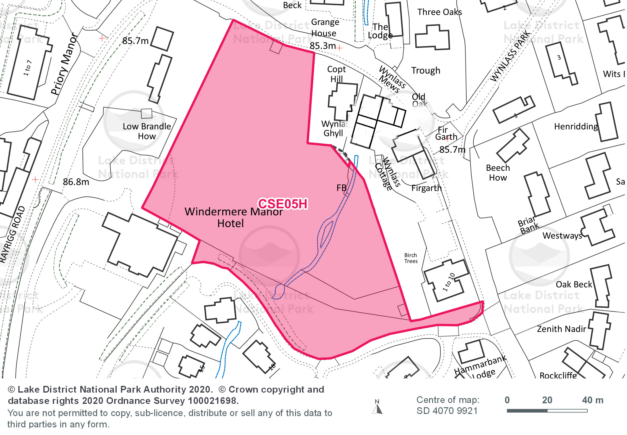
Site area (hectares): 1.21
Use: Housing
Site requirements:
- A site specific flood risk assessment is required for all uses as the site is over 1 hectare.
- Surface water drainage strategy that considers surface water management and attenuation measures such as Sustainable Drainage Systems due to the topography. Any development should restore or enhance the watercourses for the benefit of flood risk and biodiversity.
- A Heritage, Design and Access Statement and a World Heritage Site Checklist.
- Vehicular access should be taken from Priory Grange instead of from the A591. Option 2 as outlined in the access report is the preferred option for vehicular access. Pedestrian and cycle access can be taken from Options 1 and Option 4. Emergency vehicle access should be provided onto the A591.
- Tree survey required.
- A planting scheme to identify which trees should be retained and where new planting should be provided. The site layout will need to reflect the need to maintain the root protection area of existing trees.
- Extended Phase 1 Habitats Survey to establish potential ecological constraints to development. This survey will inform the requirement or otherwise for further surveys such as an Invasive Species Survey.
- Archaeological field evaluation due to the presence of features recorded in the Sites and Monuments Record in close proximity to the site.
- Plant appropriate native trees and, or create new drystone walls to enhance ecological connections with other habitats and biodiversity.
- Sewerage capacity issues may need to be investigated at the time of an application.
- Retain the Amenity Local Green Space. Should a loss of any Amenity Local Green Space be required to provide a suitable site access, any losses will be replaced on site by improving the quality and quantity of the remaining Amenity Local Green Space.