This project is complete, view route page: West Windermere Way
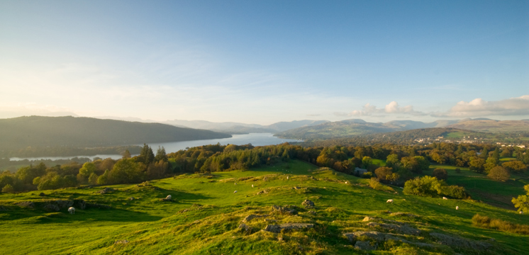
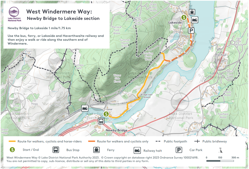
This part of the Lake District is very busy. We encourage people to get more active, and to use the car less. The West Windermere Way is an accessible and mainly off-road trail linking Newby Bridge and Lakeside, and further north to Finsthwaite and the Lakeside YMCA.
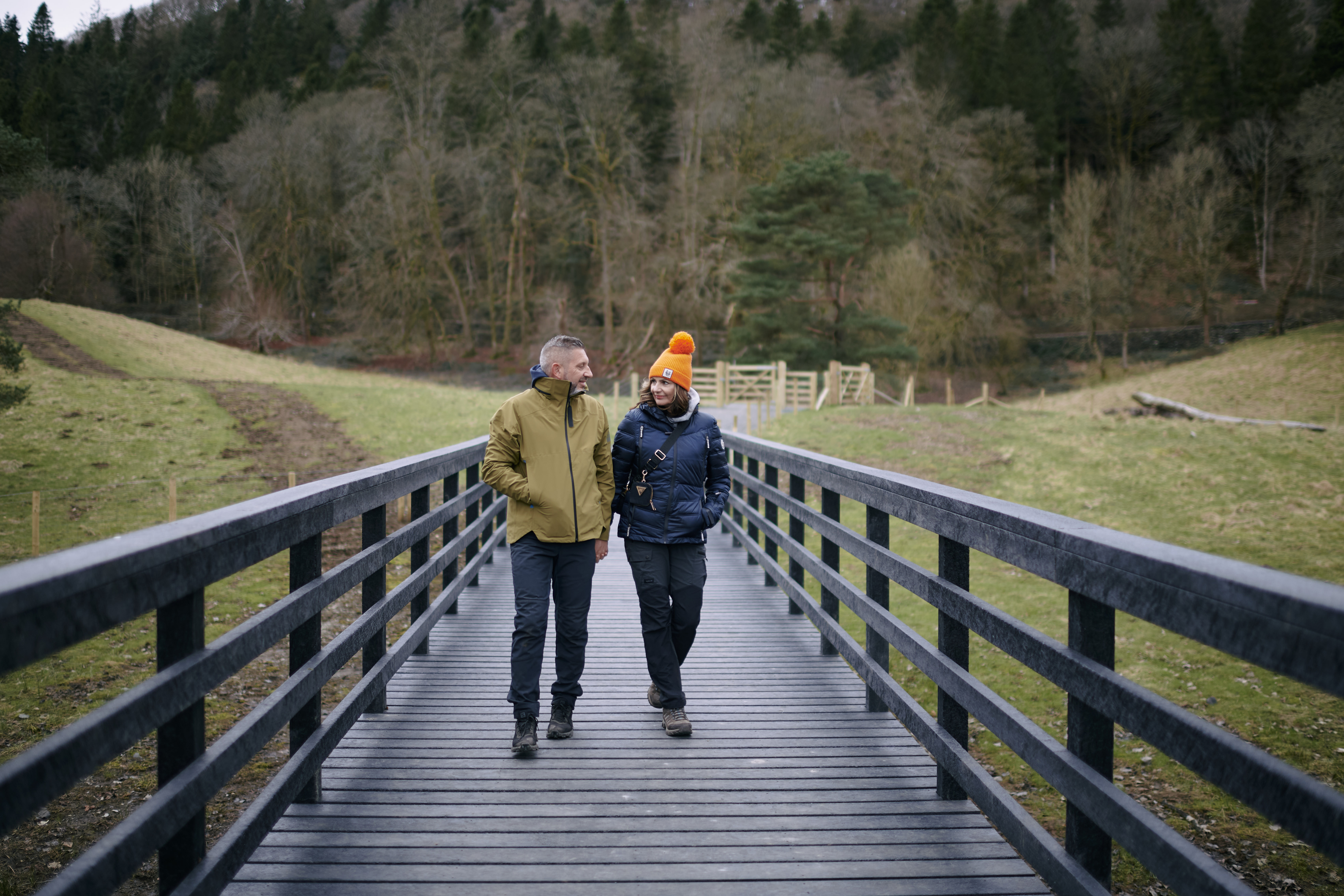
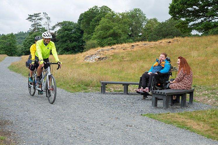
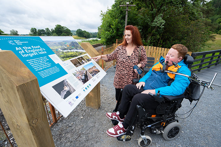
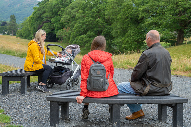
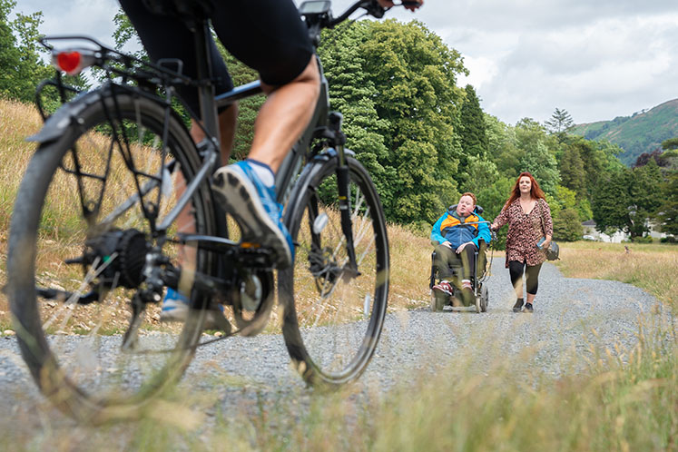
The aim of the West Windermere Way is to give people travel options along the western shore of Windermere. It’s ideal for families who want to be able to walk safely along the west side of Windermere and to enjoy the stunning views. Linking the key visitor attractions in the area using the trail helps people to stay longer and explore the area without needing a car. The route avoids most of the roads, and the path is as accessible as possible. It is suitable for walkers, families featuring little legs and pushchairs, cyclists, and horse riders. Some sections are accessible for wheelchair users (this section is an accessible route: Miles Without Stiles Route 51).
Contractors began work in July 2022, installing raised boardwalks, a new bridge over the railway, surfacing and fencing. The first section of the West Windermere Way opened in Spring 2023, just in time for the Easter holidays. The route follows some lakeshore but it also leads from the lake towards Stott Park Bobbin Mill and High Dam. The long-term aim is for the route to link to the Windermere West Shore Way and Windermere Ferry line, once funding and permissions are obtained. People will eventually be able to travel from Newby Bridge to Wray Castle using the network of trails. Once completed, the entire route will connect buses, boats and trains, creating great new sustainable journey options in the heart of the Lake District.
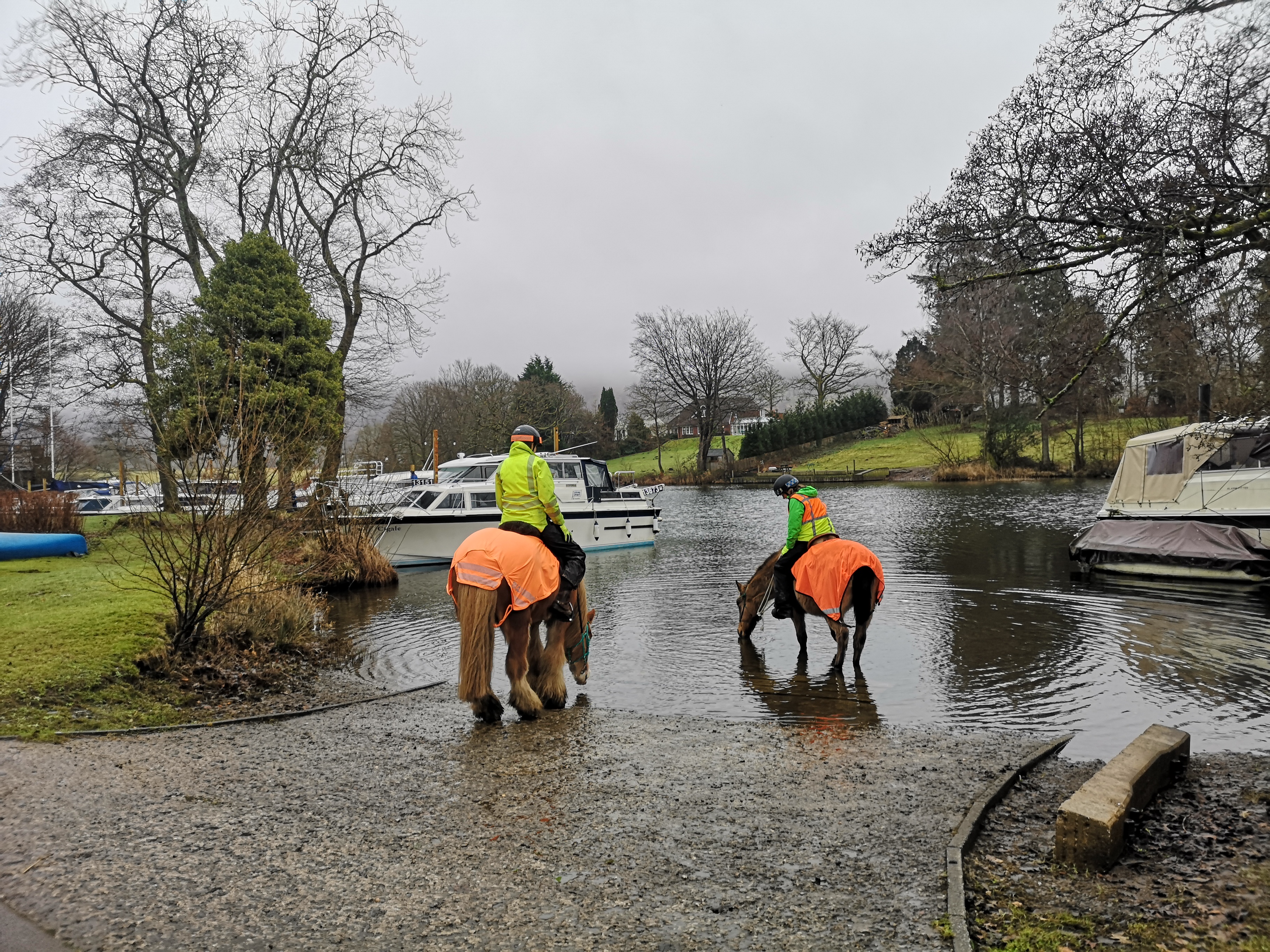
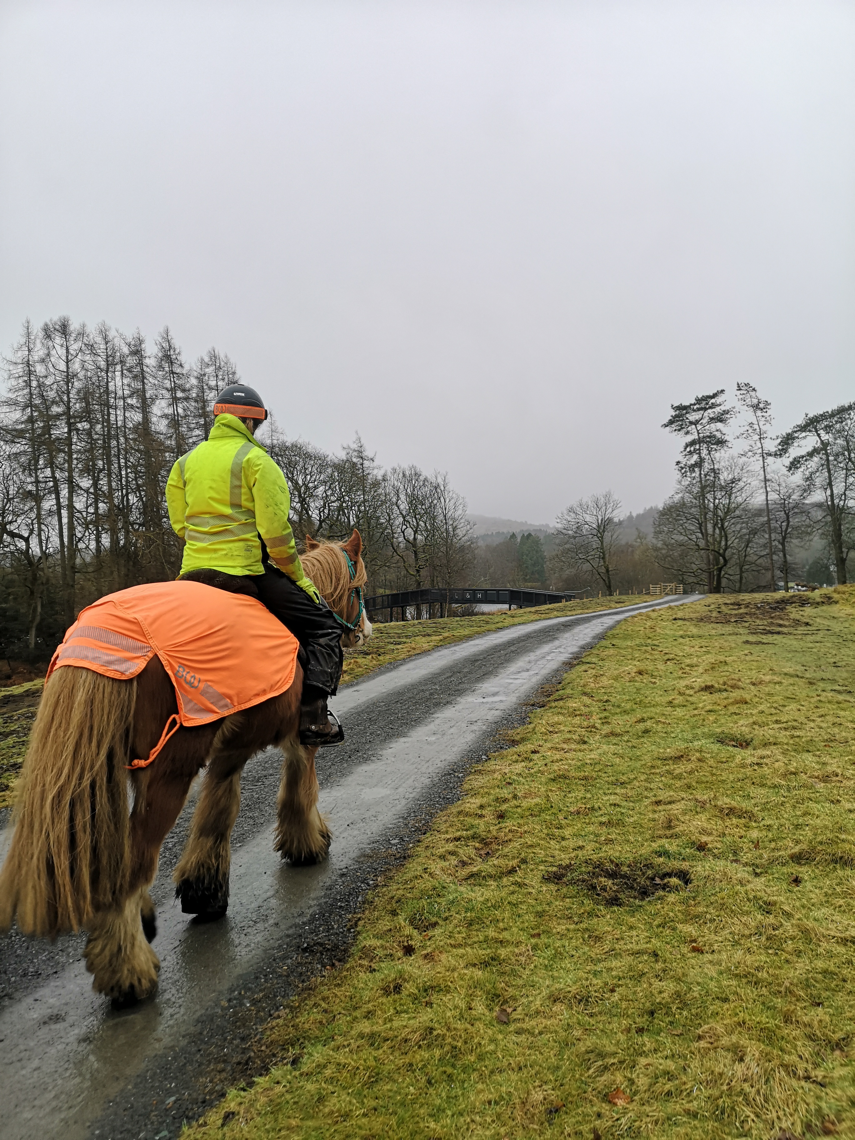
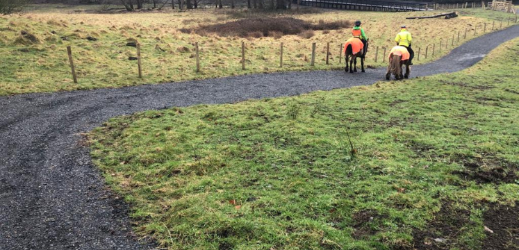
While some sections are for horse riders, cyclists and walkers, please refer to the full West Windermere Way route description to check which sections are suitable for your preferred mode of transport. We have worked with Cumbria Bridleways Society and the British Horse Society to ensure sections of the route are accessible to horses where landowners have granted permission. Please note the spur that leads to Lakeside over the section of boardwalk is not accessible to horses, and horse riders need to follow the path and join the road to get to Lakeside.
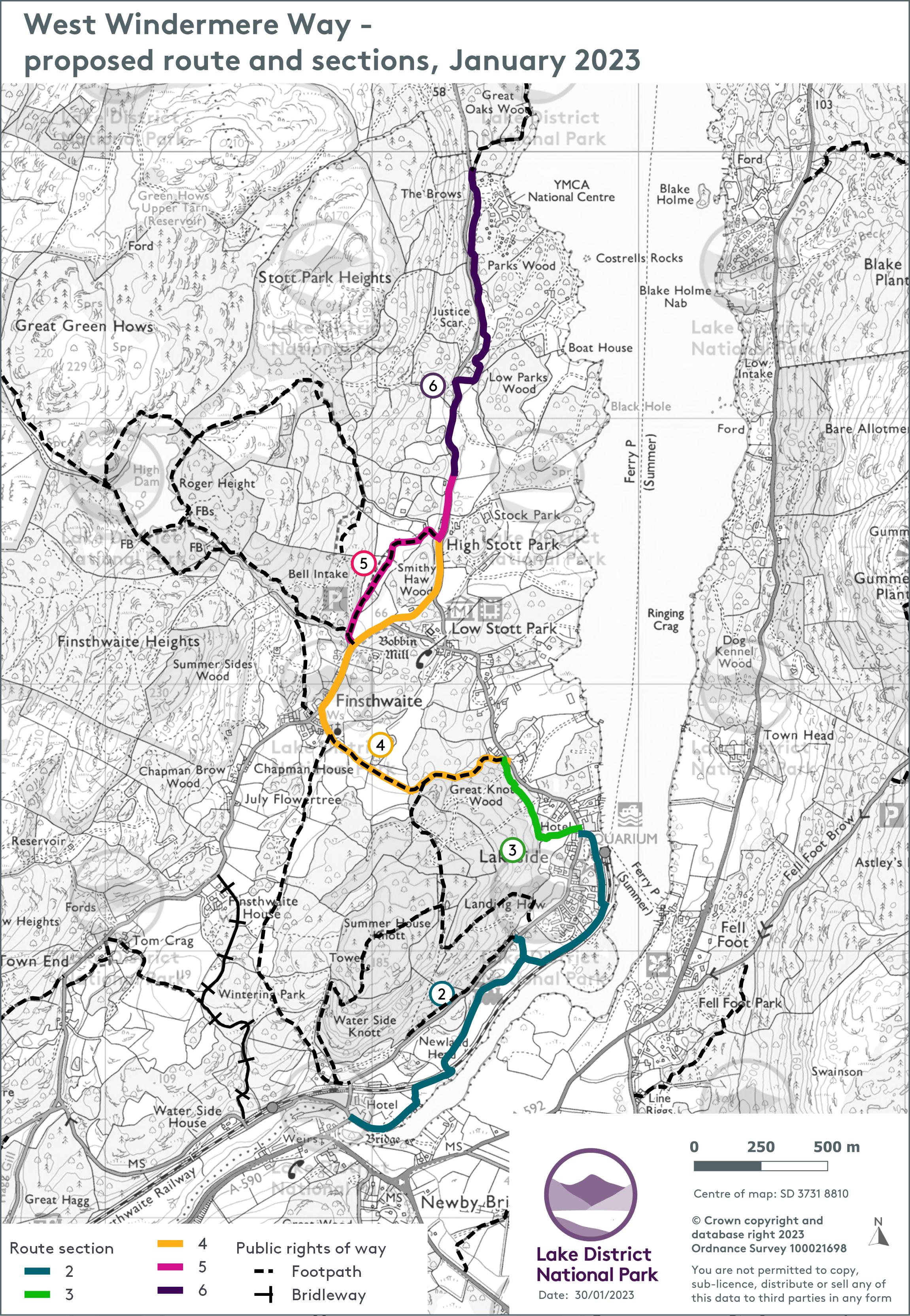
Proposed route of the West Windermere Way, showing route sections
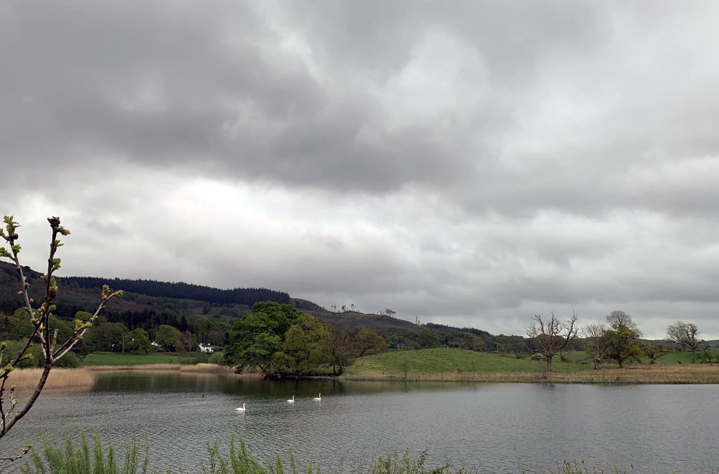
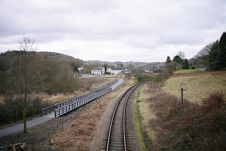
The view across the River Leven from part of the proposed route from Newby Bridge to Lakeside.
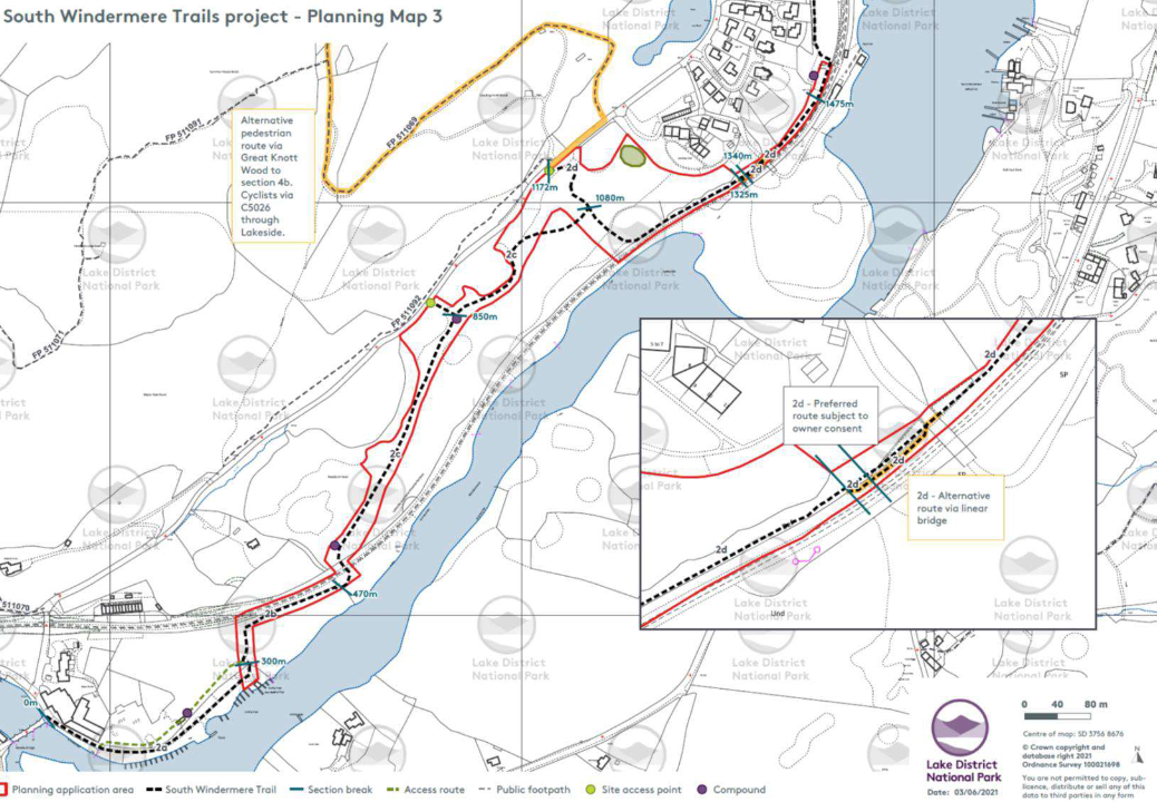
Map showing the section of path from Newby Bridge to the Lakeside Hotel and Lakes Aquarium.
Images above: This part of the route links Newby Bridge and Lakeside, offering a safe and enjoyable connection between these two important transport hubs. It improves accessibility for walkers and cyclists, helping create a safe and sustainable travel option.
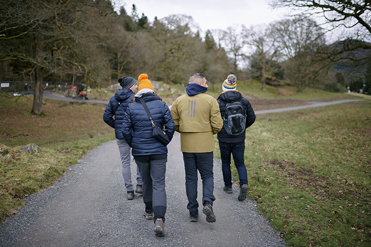
We had to create the route in sections. We had to plan carefully for each section to go through the planning application process. In some places we adjusted our original plans to avoid affecting residents and wildlife.
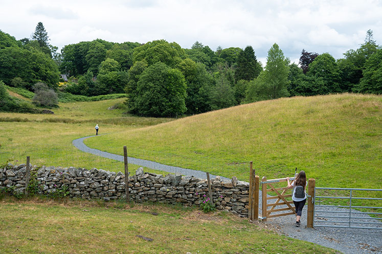
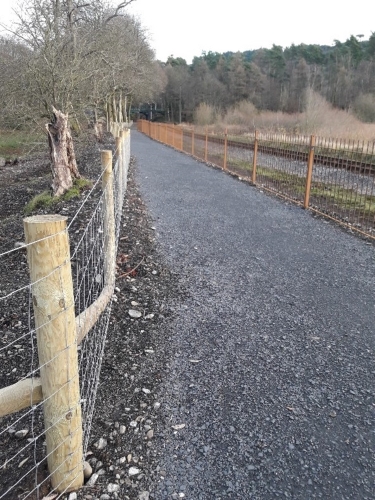
We used existing public footpaths for some of the route, but we upgraded some sections and we have built new paths too. The majority of the route is a public right of way, with a few sections having permitted agreements.
It is between 2m and 3m wide. There are grass verges on each side where possible, and it is fenced where needed.
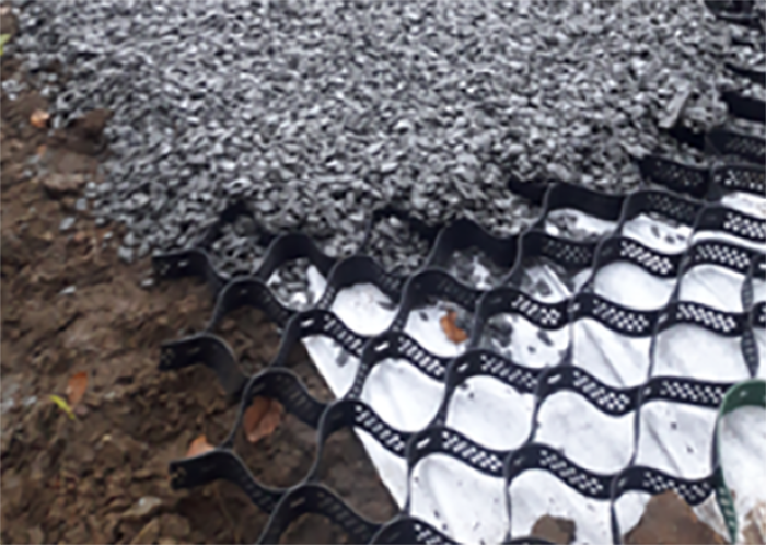
We have used locally sourced stone to create a hard, crushed stone surface.
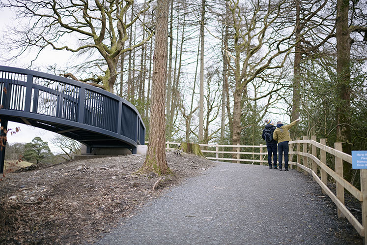
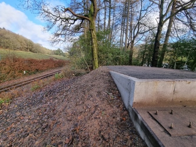
We installed two sections of raised boardwalk over areas that get very wet or are sensitive habitats.
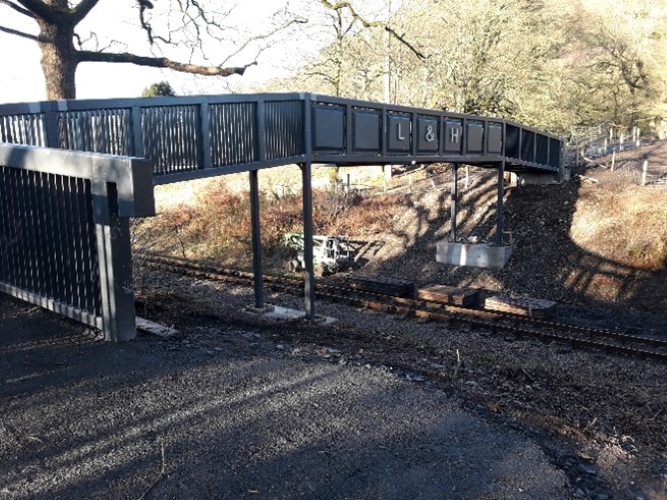
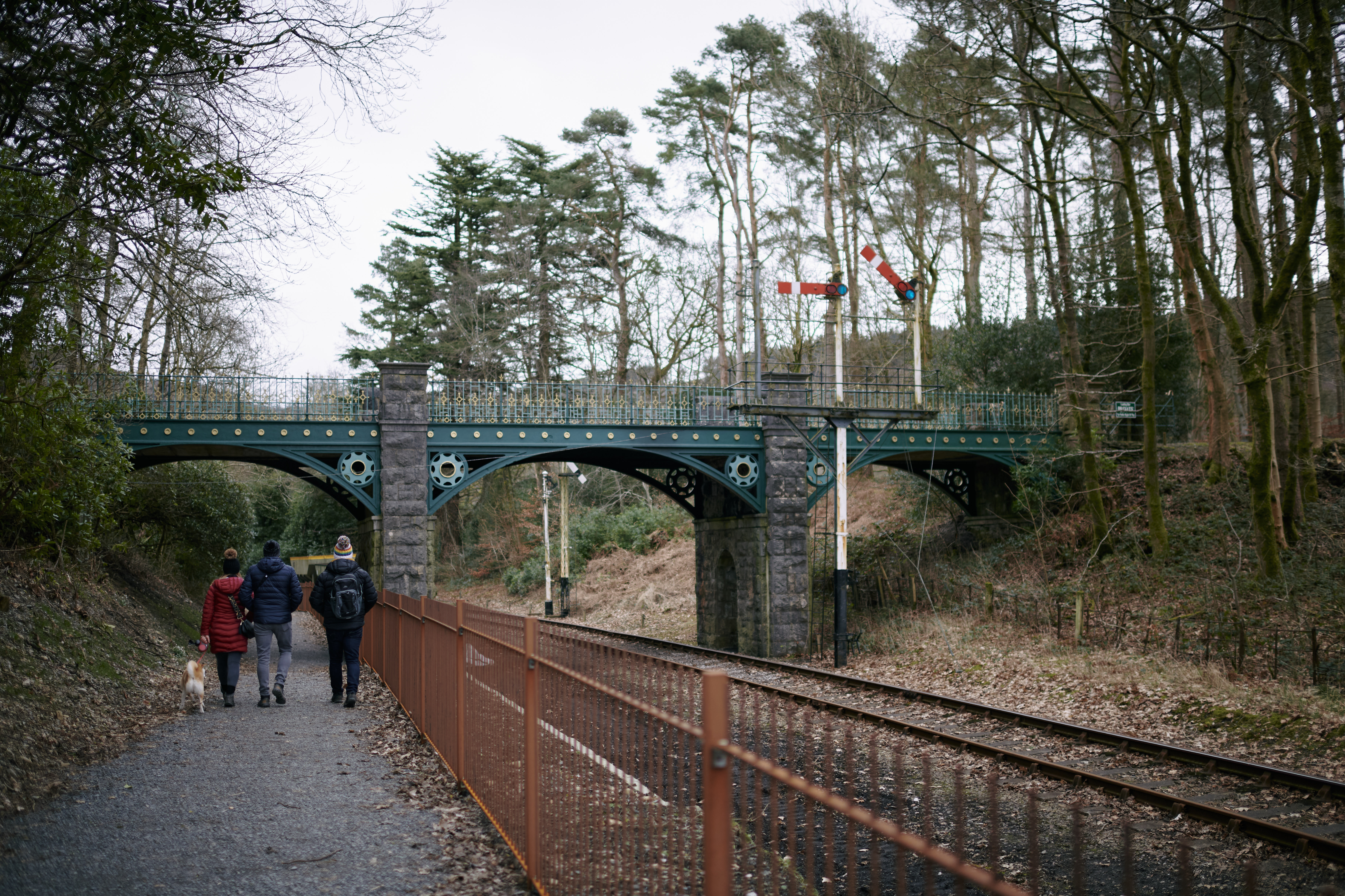
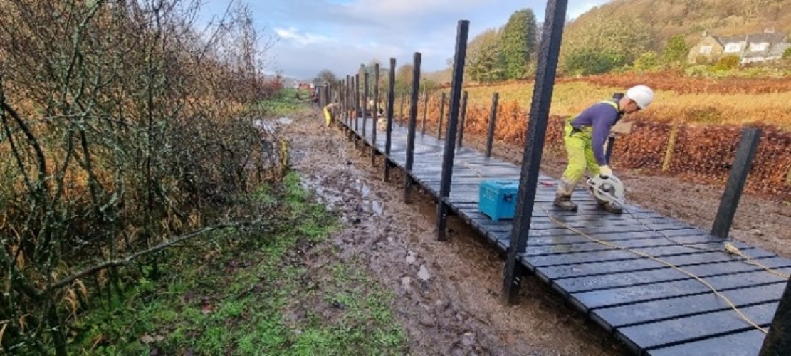
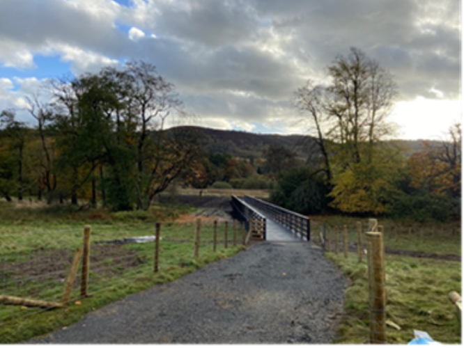
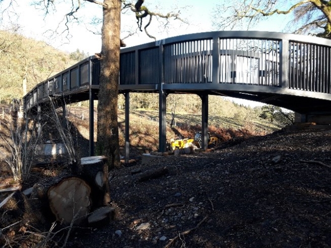
We even built a new bridge over the railway.
Information boards are provided to help people on the route find out about the areas they are passing through.
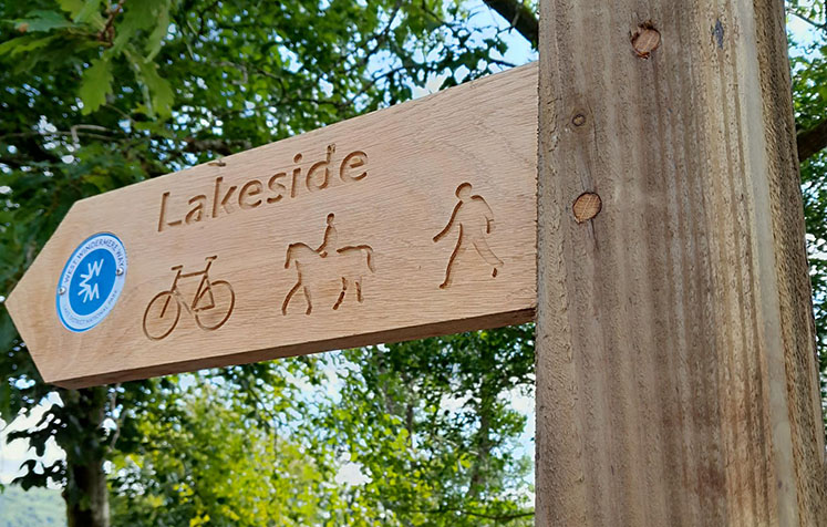
Waymarkers show clearly which path you should follow to stay on track.
See the West Windermere Way Route 51 page for further information on the route including points of interest, descriptions and how to get there.
We led the project, but we weren’t alone. We worked closely with landowners, stakeholders, and local parish councils. The work was funded from the European Structural and Investment Funds and the Cumbria Local Enterprise Partnership. The West Windermere Way is part of Low-carbon Lake District, a partnership approach to reduce carbon in the National Park and mitigate against the effects of climate change on the landscape. This project is also part of the Optimising Connectivity programme, a partnership approach to improving sustainable transport links and economic growth in the local area.
This project is partly funded by:

![]()
![]()
West Windermere Way is a mainly off-road route along the western shore of Windermere between Newby Bridge and the Ferry line, linking to the existing Windermere West Shore Way between Ferry House and Wray Castle. The new route follows the lakeshore in some areas, but also heads away from the lake to key visitor attractions. Some of the route already exists as public footpaths. This project includes building new sections as well as upgrading some existing paths. The first section of the West Windermere Way between Newby Bridge and Lakeside opened March 2023 and can be used by walkers, horse riders or cyclists. This section of the route provides a safe off-road link between Newby Bridge and Lakeside, as it goes along a section of fenced off railway, through parkland and offers views of Windermere. See blog.
The project involved building the path using locally sourced stone to create a hard crushed stone surface, to make it as accessible as possible. Between 2-3m wide with grass verges on each side where possible with fencing on one or both sides as needed. Also the build of a new bridge over the railway, a raised boardwalk over areas that get very wet, and new embankments and putting in waymarkers and information signs to help people follow the route and learn about the local areas they are passing. The whole route was planned to be a public right of way, with a few sections having permitted agreements.
An interpretation brief was written for potential Design Consultants. The route to be promoted on the ground with fingerposts, and a specific waymarker. The interpretation brief has been written to design a specific waymarker that will be used to promote the route, in addition to onsite interpretation panels that will be installed at five locations along the route. The deadline for this work - end of June 2023 to link with the whole route being open and useable for the summer.
Proposed route of the West Windermere Way, showing route sections
The view across the River Leven from part of the proposed route from Newby Bridge to Lakeside.
Map showing the section of path from Newby Bridge to the Lakeside Hotel and Lakes Aquarium.
Each section was looked at carefully to see if we needed to make any changes to the planned route to help look after wildlife, like roosting bats, or to be considerate to neighbouring houses. We did this by putting each section through a planning application, so the route may change a little in some places from our original plans.
This section is now open. The contractors commenced work in July 2022, installing two sections of raised boardwalk, a new bridge over the railway, carrying out surfacing works and installing a small section of fencing at the northern end of the route.
We have worked with Cumbria Bridleways Society and British Horse Society to ensure this section of the route is suitable for horses, including checking the new bridge over the railway and the raised boardwalk by the Swan. Please note the spur that leads to Lakeside over the section of boardwalk is not accessible to horses, and horse-riders need to follow the path and join the road to get to Lakeside.
Watch behind the scenes footage of the Haverthwaite and Lakeside bridge being installed on the West Windermere Way Trail.

Footings for the new bridge
New boardwalk and path leading to the railway embankment
New path along the railway embankment

New section of boardwalk being installed near The Swan hotel

Works building the new bridge over the railway
Works building the new bridge over the railway
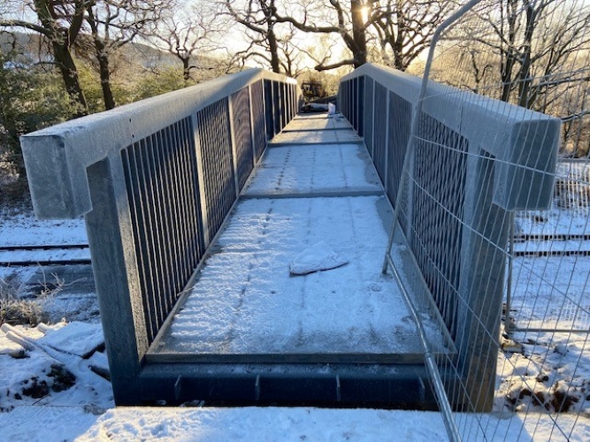
The deck of the new bridge
Follow the first section of our West Windermere Way route from Newby Bridge to Lakeside in this video. A one mile route open for walkers, horse riders and cyclists. Pass by the Haverthwaite to Lakeside railway line, through parkland and views of Windermere


