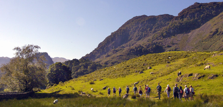
The Lake District National Park contains more than 3,200 kilometres of Public Rights of Way. They're used by walkers, cyclists and horse riders and vehicles.
All public rights of way are highways in law. They are normally just simple paths and tracks through woods, farmland, in countryside or near towns.

Foothpath: May be used only on foot.
Waymarked by a yellow arrow.

Bridleway: May be used on foot or on horseback. Horses may be led and in some cases there is the right to drive other animals. Pedal cycling is also permitted, providing cyclists give way to horse riders and pedestrians.
Waymarked by a blue arrow.

Byway open to all traffic: May be used by traffic that can use bridleways as well as any kind of wheeled vehicle, including motor cars, motorcycles and horse drawn vehicles.
Waymarked by a red arrow.

Restricted byway: The same as a byway, except that they cannot be used by mechanically propelled vehicles such as cars or motorbikes.
Waymarked by a 'victoria plum'-coloured arrow.

Permissive or permitted paths: These are not 'rights of way' as such but are paths over which the landowner has reached an agreement with the Authority to allow linear public access. This permission may be withdrawn or the route altered over time. Permission may be given subject to certain restrictions.
Waymarked by a white or a black arrow.
Other public highways maintainable at public expense: Commonly known as unsurfaced/unclassified county roads. The exact status of these ways differs in each case, if known at all – however, there will be a minimum of foot rights and probably more.
As of October 2019, the total length of Rights of Way was 3,203 km (1,927.5 miles).
Ordnance Survey 1:25,000 "Explorer" maps show rights of way in green, and acknowledged permissive paths in pale red. Their 1:50,000 "Landranger" maps show rights of way in red.
All recorded public rights of way are shown on the Definitive Map and Statement held by Cumberland County Council and Westmorland & Furness County Council.
Rights of way give a 'right of passage' across land. Anyone may use a right of way at any time, just like a normal road.
You can stop for a while – to admire the view, take a photograph, eat a sandwich or sit down and rest – providing you stay on the path and do not cause an obstruction. You can take 'normal accompaniments' on the right of way such as binoculars, dogs under control, and buggies.
However you can not roam wherever you want, or use the path or surrounding land for other purposes. If you do anything that is not reasonably part of your journey, such as deliberately disturbing people or animals, then you may be regarded as a trespasser.
Yes. Under the Countryside Act 1968, we have a duty to erect signposts at every point where a footpath, bridleways or byway leaves a metalled road. We carry out regular surveys and renewal programmes to ensure that as many ways as possible are signed.
Waymarking is a means of indicating the line or direction of a path at points where it may be difficult to follow. Indicators can range from splashes of coloured paint on walls to wooden arrows and plastic discs - see the photos above under "What's the difference between a footpath and bridleway?".