


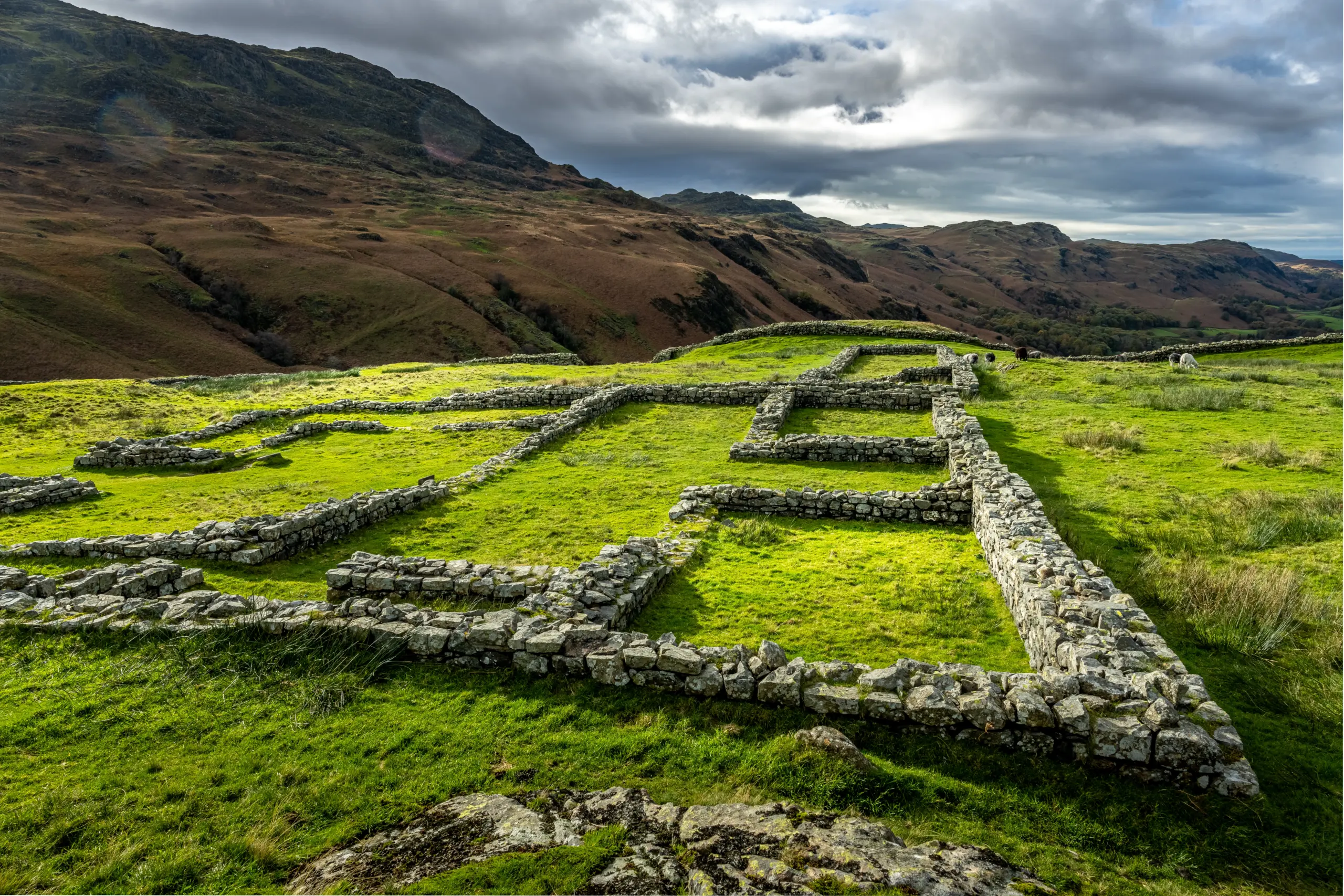
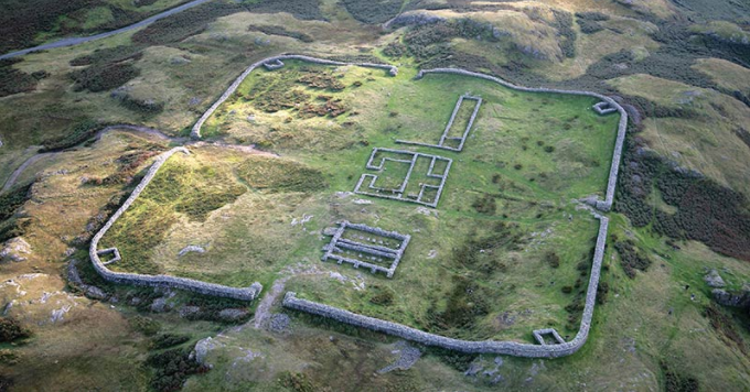
Hardknott Roman Fort
This far-flung outpost of the Roman Empire guarded the pass on the road from Ravenglass to Ambleside. It was built in the second century during Hadrian’s reign and garrisoned by troops from the eastern Adriatic, who policed the area and defended the frontier. Thanks to its remote setting, the ruins are well preserved. Look out for the barracks, commandant’s house, parade ground and bath-house. Managed by the National Trust and English Heritage, Hardknott Roman Fort is free to visit.
Location: Western Lake District, near Ravenglass.
Grid reference NY218015.
///perplexed.projects.says
14.5 kilometres (9 miles) north east of Ravenglass, at west end of Hardknott Pass. Parking is limited with a steep walk to the site. Please note that Hardknott Pass is a challenging drive and may be hazardous in winter.
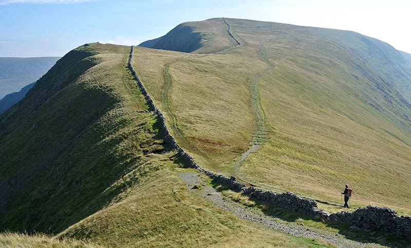
High Street Roman Road
If ‘High Street’ makes you think of shopping, think again! This is a 2,000 year-old road built by the Romans to link their forts at Brougham near Penrith and Ambleside. It’s believed to follow the line of a much older, prehistoric track. The highest fell it crosses is named after the road. On some stretches you can see kerb stones and patches of metalling. Part of route is managed by the National Trust, but all of it is free to access – you just have to be prepared to do a bit of fell walking to get there!
Location: North and Eastern Lake District, the whole route is 20 kilometres (12.4 miles) from Ambleside to Penrith.
Grid ref NY425060- NY490244.
///view.snacking.cried
///doped.stud.webcams
///stores.nation.sapping
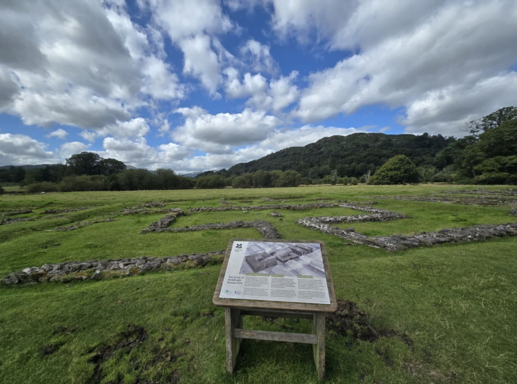
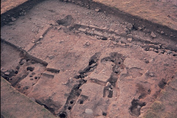
Ambleside Roman Fort of Galava
A century ago, there was little sign that a Roman fort once stood here, guarding the supply route from Ravenglass. Today you can clearly see the foundations of the headquarters building, commandant’s house, granaries, gates and defences, all exposed by excavations in 1914-20. The dig also showed that this stone fort, built in the second century AD, replaced an earlier wooden one. You can see some of the finds in . Managed by the National Trust and English Heritage.
Location: Central Lake District near Ambleside, at the north end of Windermere.
Grid reference NY372034.
///admits.commenced.defeat
1 kilometre (0.6 miles) south of Ambleside. Short walk from car park along A593.
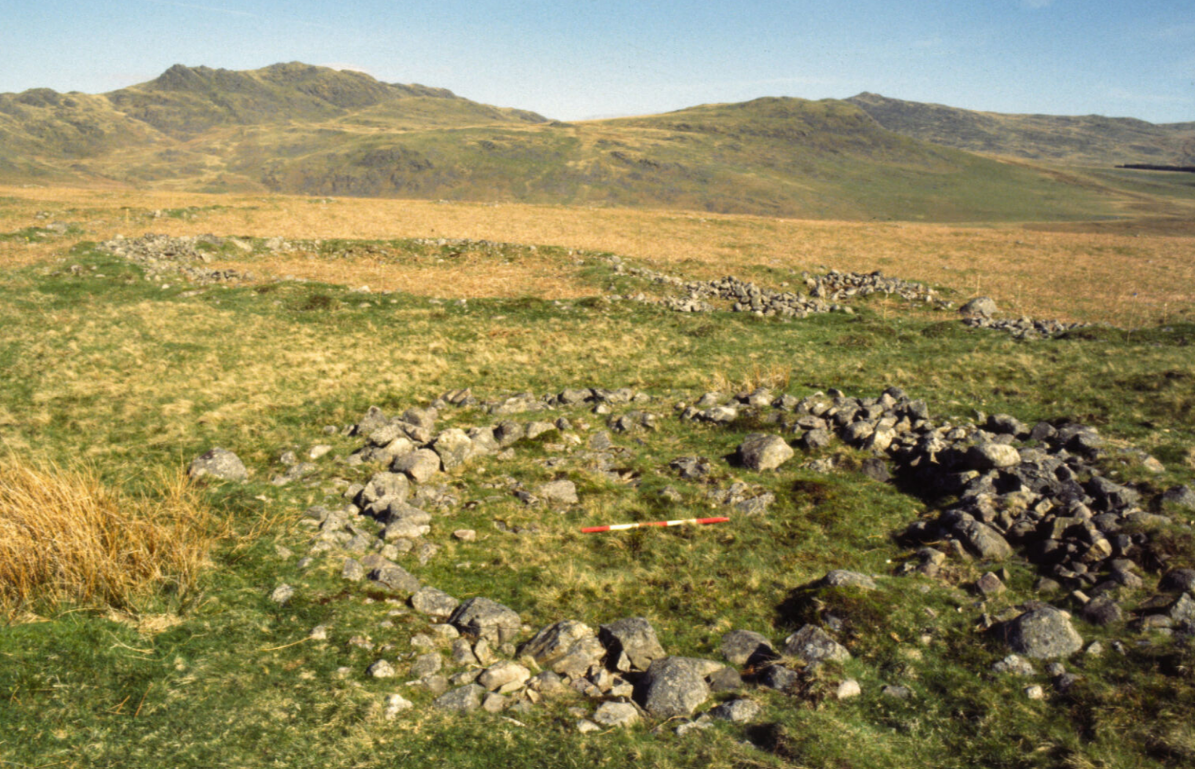
Barnscar Romano-British Farmstead
This isolated site was a substantial settlement in Roman times. But the residents would have been British, and were clearly not keen on new-fangled Roman house designs! You can see the remains of at least six round houses, and three large enclosures for livestock. On the nearby slopes are field boundaries and a trackway leading to the farmstead. There are signs, too, of a medieval ‘shieling’ seasonal house – overlying the settlement.
Location: Western Lake District, near Ravenglass.
Grid ref SD132959.
///even.connected.atoms
On Birkby Fell, 3 kilometres (1.9 miles) south east of Muncaster Castle. Roadside parking at Devoke Water, then follow bridleway for 4 kilometres (2.5 miles).
Ravenglass Roman Bathhouse
The 1,000-strong garrison at Ravenglass came here to scrub up. It’s one of the best preserved Roman military bathhouses in Britain, with walls standing nearly 4 metres (12 feet) high. Two rooms with doorways and windows survive, but excavations have revealed more rooms, with plumbing for hot and cold baths. Only faint traces remain of the adjacent fort, which was a major Roman naval base and regional supply point for 300 years. Managed by English Heritage, Ravenglass Roman Bathhouse is free to visit.
Location: Western Lake District, near Ravenglass.
Grid reference SD088958.
///servicing.active.flamingo
1.2 kilometres (0.25 mile) south east of Ravenglass, off minor road leading to A595.
Disabled access: by car to end of track, view from this side of the fence.
Aughertree Fell settlement
here are three farmsteads here which date from Roman times, but reflect an older, local way of life. Each farm contains hut circles and animal pens, enclosed by parallel banks and a ditch. Outside lies a sprawling complex of fields of various shapes and sizes. Some of the boundaries are obvious, but the full extent of plots and connecting tracks can be seen only through aerial photography.
Location: Grid reference NY264381.
///airstrip.liner.eager
Near minor road between Uldale and B5299. Roadside parking 2 kilometres (1.2 miles) north east of village, then short walk on bridleway.

