This section summarises how new active travel routes will be integrated with public transport, signage, seating and other facilities.
Hubs are the settlements where residents live and where visitors are more likely to be staying or starting their day visit. In the Lake District National Park Local Plan, they are identified as rural service centres.
The strategic and secondary routes on the network plan have been designed to link rural service centres and where shorter local links are proposed, to connect these with the surrounding countryside or visitor attractions.
As hubs these should already have facilities required such as accommodation, food, shops, toilet facilities, public transport stops, stations or interchanges and information. To become active travel hubs where needed they should also have cycle parking, cycle hire, waymarked walking, cycle routes, accessible routes and information about routes in formats suitable for that location. Table 1 summarises the facilities available in rural service centres, priority should be given to improving gaps in facilities and improving existing provisions where they are not sufficient.

Secure and attractive cycle parking is an integral part of any cycle network and can have a significant influence on cycle use. Whilst most of our settlements have cycle parking to some extent, it can be inadequate, poorly maintained, inaccessible to disabled cyclists and too often hidden away in the corner of a car park, leading to fears of personal security and cycle security.
LTN1/20 sets out that cycle parking should be provided in the following locations:
And goes on to provide detailed guidance on the siting, quantity, quality and inclusivity of cycle parking.
As part of the work, we and partners are undertaking on transport plans on a valley basis we will audit existing provision in relation to LTN1/20 standards and develop a pipeline of projects. We will also work with developers to ensure that cycle parking is embedded in new developments. We will also ensure that cycle parking provision is an integral part of any new route development.
Public air pumps and tool kits can also be provided at key locations, as we trialled under the GoLakes Travel programme.
Village and town centres in the Lake District can become crowded with pedestrians during weekends and holidays, enjoying the experience of visiting a historic settlement and supporting local shops, cafes and attractions. However, many centres are also busy with traffic, and due to their historic nature, have narrow or even non-existent footways with limited drop kerbs. This at busy times makes walking difficult and unpleasant, with pedestrians having to step out into the road at times, and for disabled people or families with pushchairs it can become impassible.
Improving the capacity and user experience of the pedestrian environment would not only lead to a better visitor and resident experience, but this in turn would lead to higher spend and higher footfall, supporting the local economy.
Interventions could include widening footways, one-way systems to accommodate this, pedestrianisation, improved crossings, removal of street clutter to enable the full width of the footway to be used, dropped kerbs and 20mph speed limits. However, it is recognised that in some locations it is challenging due to the limited road space.
Identifying and designing the interventions and their locations is beyond the scope of this high-level network plan and would need to be led by our local highway authorities with funding for additional design input, working closely with local residents and businesses.
Settlements where this approach could be appropriate include Ambleside, Bowness and Windermere, Coniston, Glenridding, Grasmere, Hawkshead Pooley Bridge and Keswick.
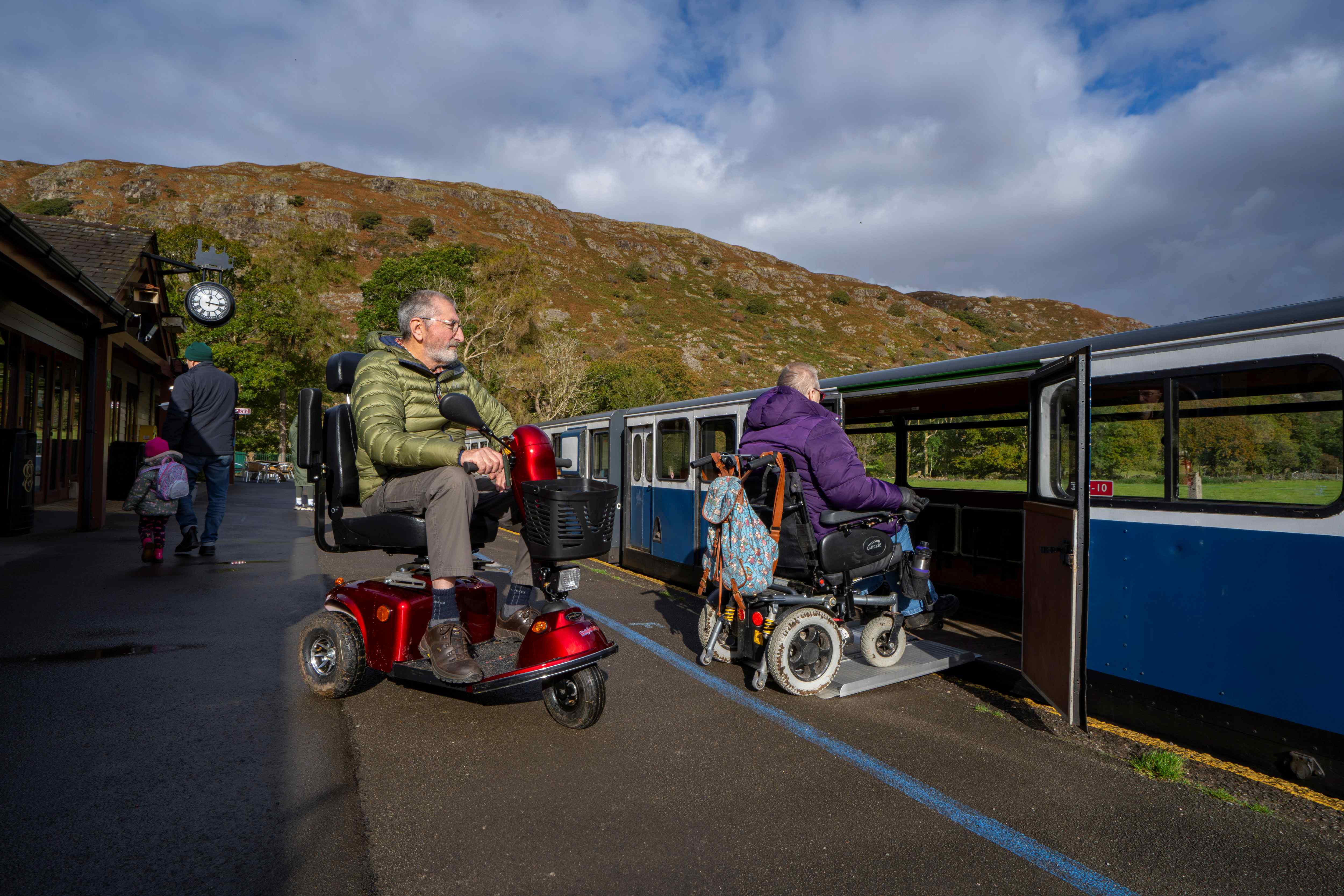
The Lake District has an extensive and frequent network of bus services in the south, centre, and north becoming less frequent in the less visited West and East. There are railway stations at Staveley, Windermere, Silecroft, Bootle and Windermere, plus others outside the National Park boundary that serve as interchanges (e.g. Penrith, Oxenholme, Ulverston).
In designing the active travel routes, we considered accessible connections to bus stops and rail stations and have developed links to them where possible. This includes the proposed link from Bootle to Bootle Station via a new development at Wellbank. Other routes are designed to start and finish at bus stops or train stations and ideally where there are other facilities, such as toilets. We will not develop or promote any routes that cannot be reached by public transport, connect with other active travel routes or to a hub. Cycle parking at public transport hubs should also be prioritised, see above.
We will work with our two highway authorities to improve bus stops, especially in terms of accessibility and security, prioritising those that will have the greatest impact.
We will continue to press for improved cycle carriage on trains and buses into the Lake District and promote and encourage cycle hire and parking at hubs where this is not available.
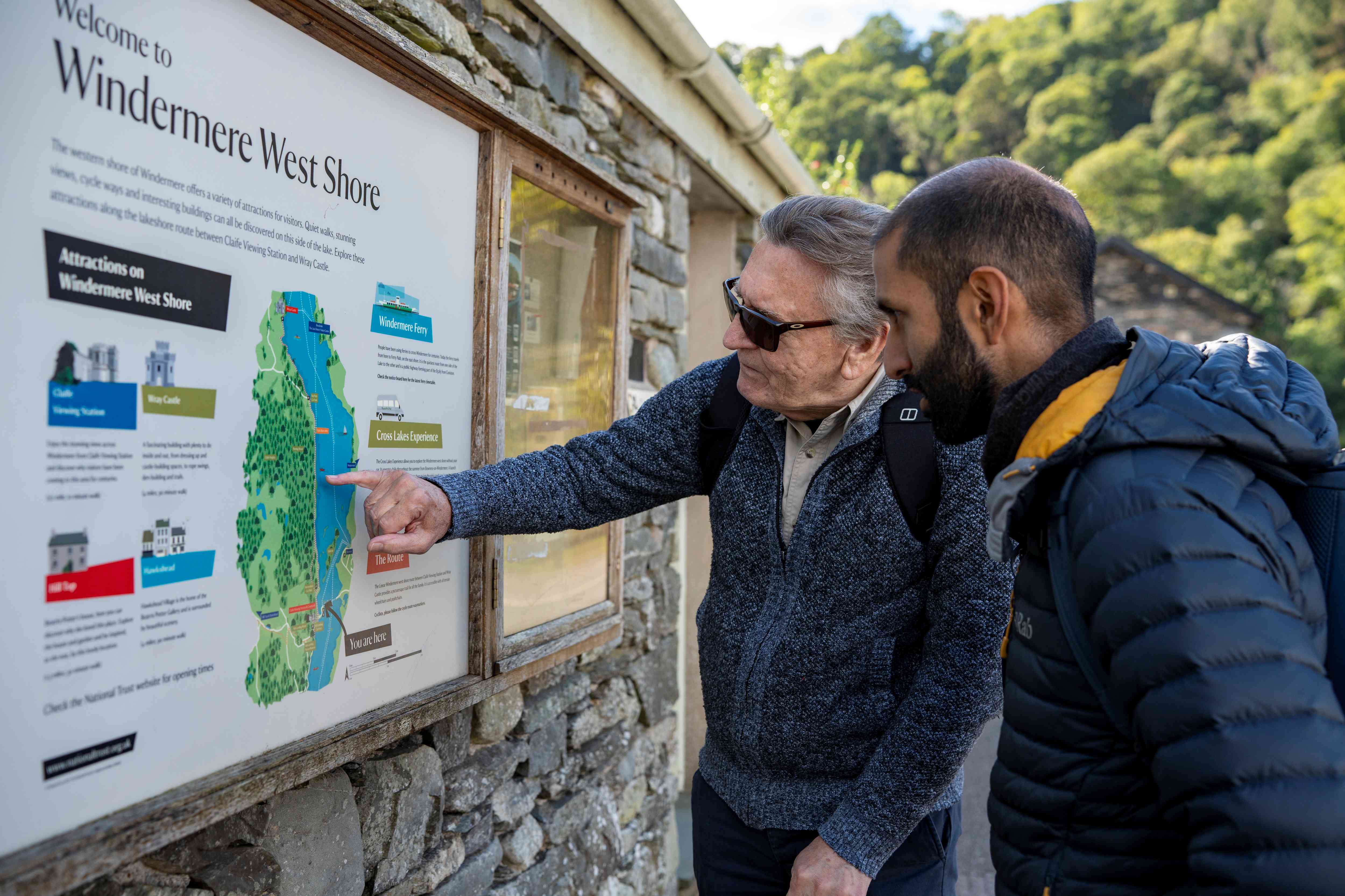
Signage of walking, wheeling and cycling routes is an essential infrastructure, giving users the confidence to travel without interruption or uncertainty. This is particularly important for visitors or for new or less frequent users of the routes. At the same time in a National Park, it is important that signage strikes a balance between avoiding clutter in the environment and ensuring legibility and visibility.
For off road routes we have developed a waymarking strategy, which shows a suite of signs with consistent style, which also allows for route branding.
On public roads signage will be governed by the DfT’s Traffic Signs Regulations and General Directions (TSRGD). National Cycle Network Routes have their own branding, which is used and will continue to be, there is also scope to include named routes (using text and numbers, logos are only allowed with DfT approval) and this could be considered for some of the suggested on-road routes in the Network Plan.
Further details can be found in LTN 1/20 Chapter 13 and the LDNPA Waymarking Strategy.
Signage should be complemented by other information including online as set out below under interpretation and behaviour change.
When developing routes, the user experience will be considered holistically.
Seating is an important part of the experience and for some users the provision of a place to rest is essential to enable them to continue on their journey. We will increase accessible seating and resting places, prioritising our miles without stiles network.
Interpretation can add to people’s enjoyment and understanding of their environment. We have recently adopted an Interpretation Strategy for the Lake District World Heritage Site and will develop interpretation within that context. Interpretation is not just about signs, there are many other media types available, including new digital opportunities, which we will use to make the offer more inclusive for people with diverse needs.
Other facilities include toilets, an important yet often overlooked element of the visitor experience. Lack of toilets can discourage new users from taking part in active travel experiences, and this impacts disproportionately on disabled visitors. We will seek to develop routes that link to existing facilities, and where possible encourage improved provision including of fully accessible Changing Places.
Vehicle parking is also an important facility, and whilst we aim to encourage more people to arrive by public transport or use active travel from their home or holiday accommodation, a high proportion of people will continue to drive to reach their active travel experience. Some disabled people are reliant on travel by car to access active travel routes so existing car parks should have ample dedicated parking spaces.
Locations of existing car parks will be considered as part of route development and information at car parks to encourage people to park up for the day and travel actively will be expanded.
To maximise the potential of existing, improved and new routes, people must know about them and be motivated to use them.
We propose using a range of media to provide information and marketing, making the most of the opportunities provided through digital means.
A more detailed action plan will be developed, but proposed actions include:
The Lake District is a popular area for road cycling, with events such as the Fred Whitton Challenge attracting 2500 riders to the challenging passes and mountain roads. In the consultation we received comments about improving the safety of road cycling through information and awareness of cycling. We propose working with partners to spread the message around considerate and safer driving around cyclists through our social media channels.
As discussed above the benefits of developing and increasing participation in active travel include:
To evaluate the impact of active travel routes data needs to be gathered, both quantitative and qualitative.
Lake District National Park Authority currently have eight people counters, mainly on new promoted trails. For larger projects, we have carried out post-completion surveys and counts, which has demonstrated and measured these benefits. For example, we know that the Keswick to Threlkeld Trail has over 250,000 users per annum, bringing an estimated economic benefit of over £15 million per annum.
Any larger developments would be monitored in a proportionate way.
We are currently evaluating how we can increase our knowledge of the overall network. This could include further people counters, but we are also trialling the use of mobile phone data on the Coast-to-Coast path National Trail in a DEFRA funded project and are working with DEFRA to model Strava Metro data. These approaches will be evaluated to help inform future approaches.
We will also be reporting to DEFRA under the ‘Protected Landscapes Targets and Outcomes Framework’ annually on measures including distance of accessible trails created, waymarking on routes improved, barrier reduction and installation of seating and resting places.
We will work with ATE and our Local Highway Authority partners to develop a monitoring framework for the outputs of this plan, including periodic progress against the actions set out.
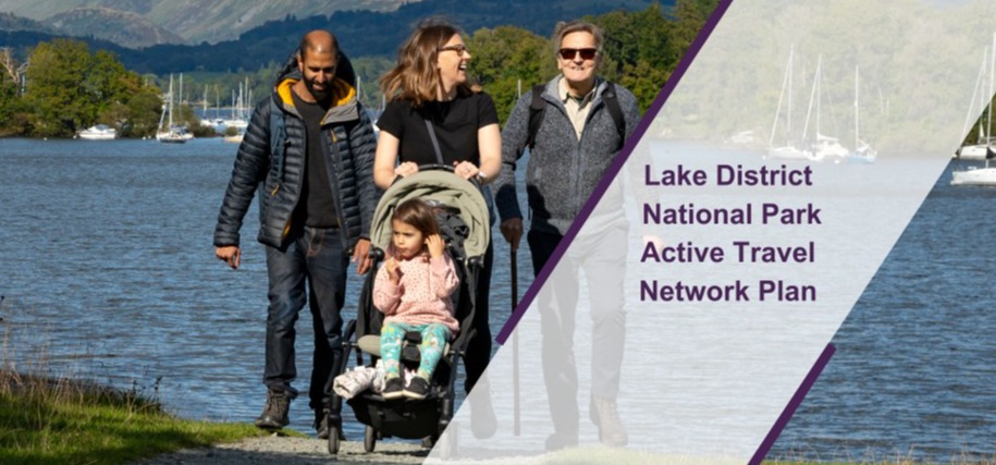
The Active Travel Network Plan outlines new walking, cycling and wheeling routes and priority areas for improvement to achieve the objectives of promoting active travel and creating safe, accessible and sustainable infrastructure for pedestrians, cyclists, wheelchair users and horse riders.


