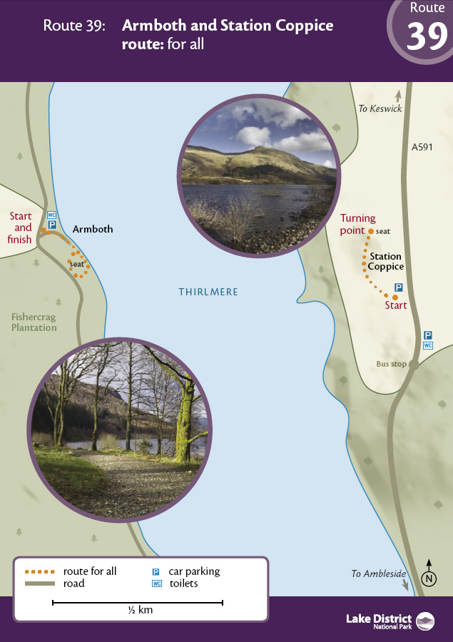
Update Feb 2024: Please note that both routes are now open again following United Utilities' works to the reservoir but both are narrowed by vegetation and do not have passing places. It is also difficult to turn around a mobility scooter at the end of the Station Coppice route. We are working with UU to try and address these issues shortly.
Two short routes with excellent views of Thirlmere Reservoir - OS Explorer Map OL5.
For Station Coppice, leave the lay-by on the Northbound side of the A591, by a path at its northern end which leads down to a gate on the right at the entry to the coppice path. Alternatively there is a steeper path with handrails leading from the lay-by to the gate but this has a step up over the curb at the top and a smaller step at the bottom. Please be aware that the route is quite narrow (1 metre wide) and there are no passing places nor turning areas, so may be difficult for those on wheeled equipment. The bench shown on the map below is no longer there.
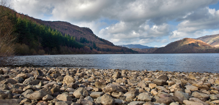
The route undulates along a well surfaced path, including a short, steep section with a 1:9 gradient and finishes with a good view out across the Thirlmere Reservoir. The wooded hills of High Seat and High Tove can be seen across the water.
Thirlmere was created as a reservoir in the late Victorian era. Previously, two small tarns, Leathes Water and Wythburn Water, were connected by a stream and small causeway bridge. They all disappeared - along with a hamlet and pub - when the valley floor was flooded.
The Armboth route leaves the south eastern corner of the Armboth Car Park on the western shore of Thirlmere reservoir. It proceeds along the shore of the reservoir for around 200m, where you will need to turn around and return on the same linear route to the car park. The 'loop' inland through the wood is overgrown and no longer passable. The bench shown on the map below is no longer there.
Station Coppice, Swirls car park (Northbound) or see route description for route from Southbound car park
Postcode: CA12 4TN
Grid reference: NY 315170
W3W: ///response.worker.brew
Grid reference: NY 3146 1714
W3W: ///storage.stream.flagging
Accessible toilets at Armboth car park and at United Utilities Swirls car park (Radar key required for disabled toilet). Nearby refreshments only at an ice cream van at Swirls car park
Bus: Station Coppice, the 555 Kendal to Keswick service runs along the A591 all year round and stops at Swirls. Car: For Station Coppice A591 from Keswick or Ambleside to Station Coppice car park (on Northbound side) or Swirls car park (Southbound). For Armboth, the minor road left from Legburthwaite, just beyond the St John’s in the Vale junction (currently closed).